Category: 7 Summits

Kurt Wedberg Climbs Carstensz Pyramid, Completes the Seven Summits!

September 23, 2012: Summit photo on Carstensz Pyramid (4884m/16,024'). From left to right: Esther Kim, Vanessa O'Brien, Andrea Cordona, and SMI founder Kurt Wedberg.

SMI founder Kurt Wedberg just returned from Indonesia where he guided a climb of Carstensz Pyramid (4484m/16,024’).  This is a write up of the trip as told by Kurt…

On September 15 I boarded a China Airlines flight at LAX bound for Jakarta, Indonesia.  I was meeting three ambitious ladies who intended to climb Carstensz Pyramid located deep in the jungle on the island of Papua.  Carstensz gained notoriety in the international mountaineering community in the 1980s when climbers started including it as one of the coveted “Seven Summits”; the highest mountain on each continent.  Carstensz Pyramid is the highest mountain on the Oceana continent.  Previously this continent was limited to Australia making the highest peak on this continent Mt. Kosciuszko (2228m/7310′).

Carstensz Pyramid (4884m/16,024') located on the island of Papua, Indonesia.

Access to Carstensz Pyramid is one of the biggest hurdles to climbing it.  The island of Papua is still inhabited by several native tribes who see very little contact with people from the outside world.  Two of the biggest tribes are the Dani and Moni.  Since we would be traveling on their land permission needed to be granted for us to walk through their territory.  We also needed their help with hiring porters to carry our gear, fuel, and supplies for 12 days in the jungle.

Kurt Wedberg with a Moni tribe elder in the town of Sugapa, Papua Indonesia.

Some of our porters from the Moni tribe in Papua.

Our team met in Jakarta on September 16 where we organized our equipment.  We then flew overnight to Timika on the island of Papua.  The weather was hot and humid in this town located a short distance from the coast.  From Timika we took a charter flight to the village of Sugapa.  Here the weather was slightly cooler but the equatorial sun was piercing and bright.  At Sugapa we arranged for Moni tribe members to porter our loads and prepared to start walking.  We would be trekking past the historical boundaries of the Moni territory and it was important that we had them with us.  The trailhead was accessed by riding on the backs of motorcycles along a dirt road for 20+ minutes.

The village of Sugapa and the runway located deep in the jungle on the island of Papua. Airplanes are their only connection to the outside world.

Moni tribe members discussing our route through the jungle and the porter loads they would carry during our trek to Carstensz Pyramid.

Esther and Vanessa on the backs of motorcycles that will take us to the start of our route. It was about a 15 minutes motorcycle ride over a dirt road.

On September 17 we began our trek.  Over the next 5 ½ days we planned to hike 100km/62 miles to reach Carstensz Pyramid.  On Day 1 we passed by several Moni villages.  It rained hard at times and we quickly learned that two of our most important pieces of equipment we brought were our thick rubber Hunter boots to trample through the mud and an umbrella.  We stayed in the furthest village along this path at 1991m/6532’.  From here the trail became less defined.  On September 18 we traversed a hillside to a large river that we paralleled for most of the 7 hours of walking.  The terrain varied from solid rock to thick mud.  Rain returned after lunch and made our path significantly muddier plus rocks and tree roots became more slippery.  Even with high top boots our pants got caked with mud.  Our camp was pitched at 2276m/7467’ in a small clearing amid thick jungle foliage next to a large roaring river.  Nearby was a creek of clear running water that provided a nice place to wash our pants and boots.  Even after these first two days it became obvious that trekking through the jungle would be hard work.  Every single step requires thought and effort.  Relaxing mentally even for one step is recipe for losing footing on the muddy wet slippery terrain.

Andrea, Esther, and Vanessa traversing a muddy slope on September 18, day 1 of the trek.

A fence made of local wood along our trekking route in a Moni tribe village.

Huts in a Moni tribe village.

Moni tribe members discussing our route for day 2, September 18.

Muddy boots on September 18.

One of many log crossings over a river.

Our camp in the jungle on September 18. At each camp we draped a tarp over a wooden frame to give us a dry place to cook and eat meals, plus give us a place to hang out away from the rain.

On September 19 our goal was to get high enough to reach the top end of the thick jungle environment and start entering a large plateau.  Our porters had a camp in mind that offered a good water source and flat terrain for camping.  The path continued to deteriorate throughout the day.  The footing became more slippery, the mud became thicker, and we found ourselves grabbing mossy tree branches to surmount steeper sections of the route.  In the middle of the route we passed a small “village” consisting of one hut and a family.  They were friendly and let us sit on the grass outside their hut and each lunch.  Weather remained warm and humid.  The clothing of choice was long pants and long sleeves for abrasion protection from plants but clothing that would offer breathability to prevent overheating.  I wore a pair of loose fitting and comfortable Patagonia pants and a wool Icebreaker short sleeve shirt.  I was the only team member who chose a short sleeve shirt.  I managed to keep my arms from getting scratched too much but the other three were happy to have worn long sleeves.  I was truly impressed with how well wool garments performed here.  The insulating properties of wool allow it to have a much wider temperature range than any synthetic material I’ve ever used.  In my pack I kept two heavier Icebreaker wool layers in case I needed arm protection and additional warmth.  The day wore on and by late afternoon it became apparent we were running out of water and no camp was in site.  Soon after our water ran out we also started losing our daylight.  We found our pace slowed in the darkness in spite of us donning headlamps.  We kept walking following our porters path finally reaching our intended camp at 3222m/10,570’ in the dark after 10 ½ hours of walking.  Tired and dehydrated we counted it a big blessing we were relieved of dealing with rainy weather while hiking today.

Our porters crossing a large river. these log crossings were numerous in the jungle. Our bare footed porters moved with ease over these wet slick logs. A fall off this log would have sent anybody into the swift fast current below with a water level several feet high.

Andrea crossing a bridge made from small and medium size branches held together by vines wrapped around small branches laid in cross sections at intervals along the bridge.

Close up photo of vines and cross sections that hold the bridges branches together.

A moni tribe member using a machete to clear jungle foliage to aid in hunting.

A Moni family and their hut in the middle of the jungle. With great amusement they teach Kurt how to use their hand made bow and arrow they use to hunt.


Negotiating the terrain in the jungle.

The team pauses for a photo during a rare sunny morning on the plateau above the jungle. The team hiked for two days over this plateau reaching an elevation as high as 3808m/12,493'.

A typical day of rain on the trail. It rained every day of this trip and with the exception of a couple days it rained during our walk. An umbrella was an invaluable piece of gear for this trip.

We woke on September 20 after a good night of welcomed rest and rehydration.  We’re now half way to our Base Camp for Carstensz Pyramid.  Over the next three days we would gain elevation and the terrain would open up offering us views of the surrounding hillsides.  We hoped this would signal an end to the mud but no such luck!  Instead of mud mixed in with tree roots and slippery rocks we had mud mixed in with wet marshy patches that would deceivingly not support body weight.  A misstep here could mean sinking in past the knee and water entering our boots.  My socks got wet each day regardless because Hunter boots are not breathable.  This is where I found my wool Icebreaker socks to be invaluable.  They would dry out at night and during the day they performed well regardless of how wet they got.  If our socks weren’t getting wet from inside the boots or from a misstep in the marsh they would get wet from the rain that came down heavy at times over the next three days.  Since we were out of the thick foliage of the lower jungle our umbrellas were easier to manage.  Arriving at camp each night with muddy boots and pants and soaked clothing we spent the late afternoons trying our best to clean up and get warm and comfortable in our tents.  We put in camps at 3569m/11,709’ and 3717m/12,194’ before reaching our Base Camp on September 22 at 4330m/14,205’.  Arriving at mid afternoon we had time to organize our climbing gear and prepare for our climb of Carstensz Pyramid in early morning.

Vanessa negotiating mud on September 22 en route to Base Camp.

September 22 en route to Base Camp. Heavy rain lasted most of the day. Now at higher elevation the temperature dropped from the warm tropical climate to much cooler requiring team members to wear a couple layers of clothing underneath their rain gear. We reached an elevation of 4500m/14,763'.

September 22: Kurt at the high point for the day at 4500m/14,763'. The last thing Kurt purchased for this trip was an umbrella from K-Mart in Bishop. This proved to be his favorite piece of gear!

Base Camp at 4330m/14,205'. Carstensz Pyramid, which was shrouded in clouds all day, is located out of the photo to the right on the other side of the ridgeline.

Our mountain was sitting in a cloud above us with rain soaking the route all day.  Finally by evening time the rain quit and revealed stars through partially cloudy skies.  Our strategy was to leave early, climb efficiently, and hopefully reach the summit by early morning.  We hoped to be on the summit and descending before any precipitation began.  Although it can (and did) rain at any time day or night the odds in the mountain environment usually trend towards less precipitation in the mornings and more in the afternoons.  Just the same we carried our umbrellas for the one hour approach and left them at the base of the route.

The rock on Carstensz Pyramid is hard limestone.  The abrasive nature of it meant it would be hard on our clothing but it also provides a lot of friction making for good hand holds and solid purchase for our feet.  The rock is also not very porous and therefore doesn’t absorb water.  Thus even after so much rain the rock was dry as we started up the route at 3:30am.  The climbing consists of scrambling on terrain anywhere from 3rd class up to low 5th class.  Fixed lines have been placed over the years on various sections and these were in varying degrees of wear.  My job on this climb was to keep these ladies safe, negotiate the most effective route, and coach them on the most efficient techniques to climb.  I checked the integrity of the lines and the anchors and as we got into the rhythm of moving we found the climbing to be very enjoyable.  As daylight approached we found ourselves high up on Carstensz Pyramid approaching the long summit ridge we would traverse.  A few 5th class moves led us to the ridge where we turned left and moved to the most exciting part of the route; a Tyrolean Traverse approximately 30m/98’ long over an airy and exposed spot on the ridge.  The challenge of a Tyrolean Traverse revolves around more mental aspects than physical.  They are usually wildly exposed (hence the need for employing this technique) and intimidating to trust at first but once you start on them it is just a matter of moving across the lines and before you know it you’re on the other side.  I rigged everybody with two safety backup systems and we clipped into five different ropes offering plenty of redundancy and piece of mind.  The remoteness of where we were was not lost on any of us!!

Vanessa feeling out her moves on a small chimney on the lower part of the route on Carstensz Pyramid.

An easier area of the climb in between 5th class sections.

Vanessa climbing a 5th class pitch directly below the summit ridge.

Esther getting close to the summit ridge.

Andrea enjoying a 5th class pitch on the route.

View of the surrounding landscape at 5:45am from high up on Carstensz Pyramid.

Esther and Andrea traversing the summit ridge below the Tyrolean Traverse.

Vanessa started the Tyrolean Traverse.

Andrea on the Tyrolean Traverse.

Esther on a small "step across" on the summit ridge.

Traversing the summit ridge of Carstensz Pyramid.

Esther and Andrea high on the summit ridge of Carstensz Pyramid.

One by one we made it across the Tyrolean Traverse then continued traversing the ridge line.  A couple more impasses were encountered that required stretching across smaller expanses but with good backups and carefully placed hands and feet these posed little problems for the ladies.  The terrain then got easier for the last few minutes leading to the summit.  Vanessa and I found ourselves slightly ahead of the rest.  I surmounted a small notch and looked up 40’ above me and realized that was the summit.  I turned to Vanessa and told her to scramble on past me to the summit and she could be the first to stand on top and I’d get some pictures of her.  She obliged and made the final steps towards the 5th of her Seven Summits!  Shortly afterwards the others joined us on the summit.  We were blessed with intermittent clouds and clear skies offering an occasional view, pleasant temperatures, and no precipitation.  We exchanged summit photos and hugs and made a couple calls on our satellite phones before it was time to descend.

Vanessa on the summit. This was the 5th of her Seven Summits. She is scheduled to go to Antarctica to attempt Mt. Vinson in November and Aconcagua in Argentina in January.

Esther elated to be on the summit of Carstensz Pyramid.

Andrea poses on the summit with the Guatemalan flag. This moment completed not only her Seven Summits but also the Adventure Grand Slam which includes the North and South Poles. She is the first female from Central America to accomplish the feat. Congratulations Andrea!!

Kurt standing on the top of Carstensz Pyramid reaching the final of his Seven Summits!

Kurt calling on his satellite phone from the summit of Carstensz Pyramid. Within minutes of reaching loved ones with the news of their successful summit an announcement was posted here on this blog.

Carstensz Pyramid summit photo: Esther Kim, Vanessa O' Brien, Andrea Cordona, and Kurt Wedberg

Retracing our steps we made it across the summit ridge and started down as light snow began to fall.  It was wet and melted upon touching the rock.  As we descended further the rock got increasingly wet until small streams were flowing down crack systems all around us.  Our gloved hands got soaked but each step brought us closer to the bottom.  Many rappels and short step downs brought us to the base of the route where our trusty umbrellas awaited us.  As the rain picked up in intensity we hiked back to our camp.  We had snuck in a successful ascent of Carstensz Pyramid and we were happy for that.  It would be another four days of trekking through mud and rain retracing our route back to Sugapa.  We managed that and in the process completed an amazing adventure on a remote and distant island in an exotic land with an experience I’m sure the team will remember for the rest of our lives!

On a personal note this was a truly rewarding experience for me.  As a professional mountain guide at SMI our goal is to keep our clients safe and help them achieve their intended goals.  Along the way we continue to make many new and dear friends.  All those missions were accomplished here.  It also completed my own Seven Summits journey.  It began 20 years ago in July of 1992 when I was a young assistant guide on my first expedition to Mt. McKinley (20,320’/6193m), the highest mountain on the North American continent.  SMI is now positioned to guide climbs on all seven continents.  I’ll share more on the journey to the Seven Summits soon.

I want to extend a big thank you to Andrea, Esther, and Vanessa for sharing such an incredible adventure on Carstensz Pyramid.  I also want to thank my family and dear friends who have been so supportive of me throughout my guiding career.  Finally, a special thank you to all of our clients who we continue to share so many incredibly memorable experiences with.  We look forward to seeing you back and to all the new people we will meet along the way.  We already have many trips lined up for the next coming year and we hope to see many of you on one soon!

The entire photo gallery from this climb can be found here:  Carstensz Pyramid September 2012


Summit Photo from Carstensz Pyramid

Kurt Wedberg just arrived back to Jakarta, Indonesia after 4 days of jungle trekking to return from the summit of Carstensz Pyramid.  Many more photos and stores will be following soon.  For the moment here’s a summit photo taken on September 23, 2012.

Summit of Carstensz Pyramid September 23, 2012. From left to right: Esther Kim, Vanessa O'Brien, Andrea Cordona, and SMI guide Kurt Wedberg.

Kurt Wedberg and Team summit Carstenz Pyramid!

Minutes ago, a celebratory satellite phone call from the summit delivered the good news that Kurt and Team have successfully climbed Puncack Jaya or Carstensz Pyramid (4884m/16023′), the highest point of the Australasia/Oceania region.

The Climbing Team consists of: Vanessa O’Brien of Boston, MA; Esther Kim of Washington DC; Andrea Cardona of Guatemala; and SMI Guide Kurt Wedberg.

This summit completes the last remaining mountaineering objective on the 7 Summits List for Kurt Wedberg. Although Kurt has climbed the other 6 objectives numerous times during his guiding career, until now Oceana remained a distant goal.

Additionally, this summit signifies the completion of the last remaining objective on the Adventure Grand Slam List for Andrea Cardona. The Adventure Grand Slam List consists of climbing the highest peak on each continent (Denali, Aconcagua, Elbrus, Kilimanjaro, Vinson Massif, Carstensz Pyramid, Everest) and skiing to both the North and South Poles. Ms. Cardona is the first woman from Central America to complete the Adventure Grand Slam.

The Team spent the past 5 days trekking through difficult and technical jungle terrain to reach the base of Puncack Jaya. Now, they will return to camp, rest, and resume their descent through the jungle to the trailhead.

Pictures and updates to follow.

AM

We Can’t Get Enough of Africa!


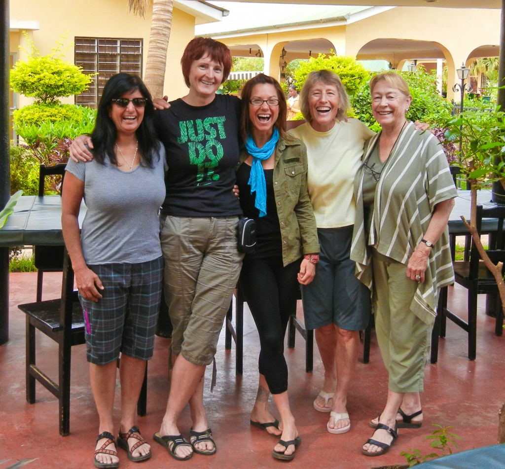
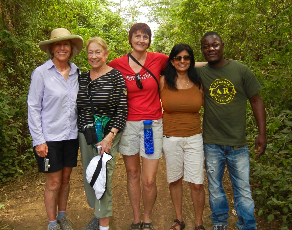
Team Nguvu Dadas (l-r): Amber, Kelly, April, Betsy, Rachel

On August 7th, team members from across North America united at the Springlands Hotel in Moshi, Tanzania. Betsy Northam and her sister Rachel flew in fresh and rested from 5 days on Zanzibar Island. The others arrived via bus ride across the Kenya/Tanzania border. The Kilimanjaro climbing team consisted of Betsy Northam of San Diego, Amber Sidhu of San Diego, Kelly Dunfee of Halifax, Nova Scotia, and SMI guide April Mayhew.  During the climb, Betsy’s sister Rachel Mueller would provide base camp support from her poolside office at the Springlands Hotel.

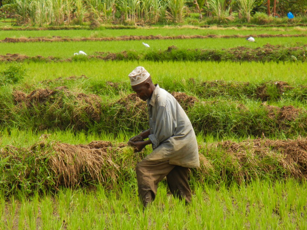
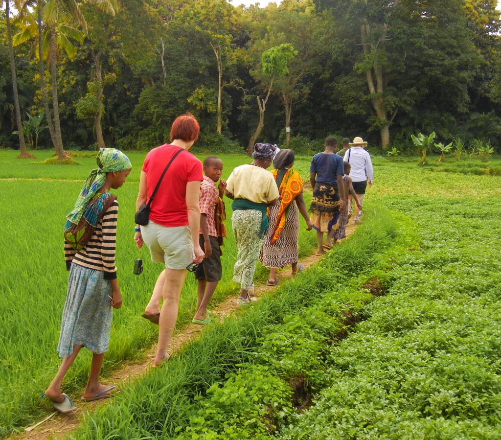
August 8: After a celebratory dinner and a well-earned night’s sleep, we stretched our legs during a morning walk through the local villages and jungles of Moshi. The terrain navigated around small neighboring farms, then broke away into a dramatic landscape of manicured rice fields with a peripheral background of untamed jungle.

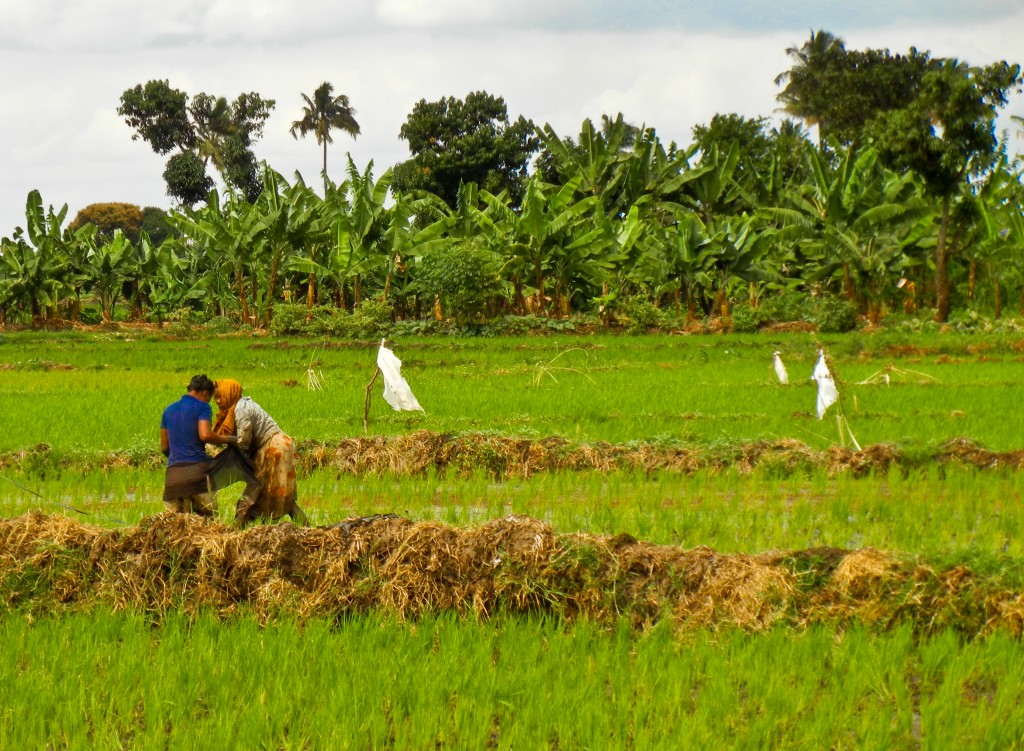
Walking with balance along the narrow rims of the fields can be tricky. Many large wild birds use the rice fields as a food source. In addition to grand views, our trek was graced by many friendly greetings from village children and rice fieldworkers.

Navigating the rice fields surrounding Moshi.

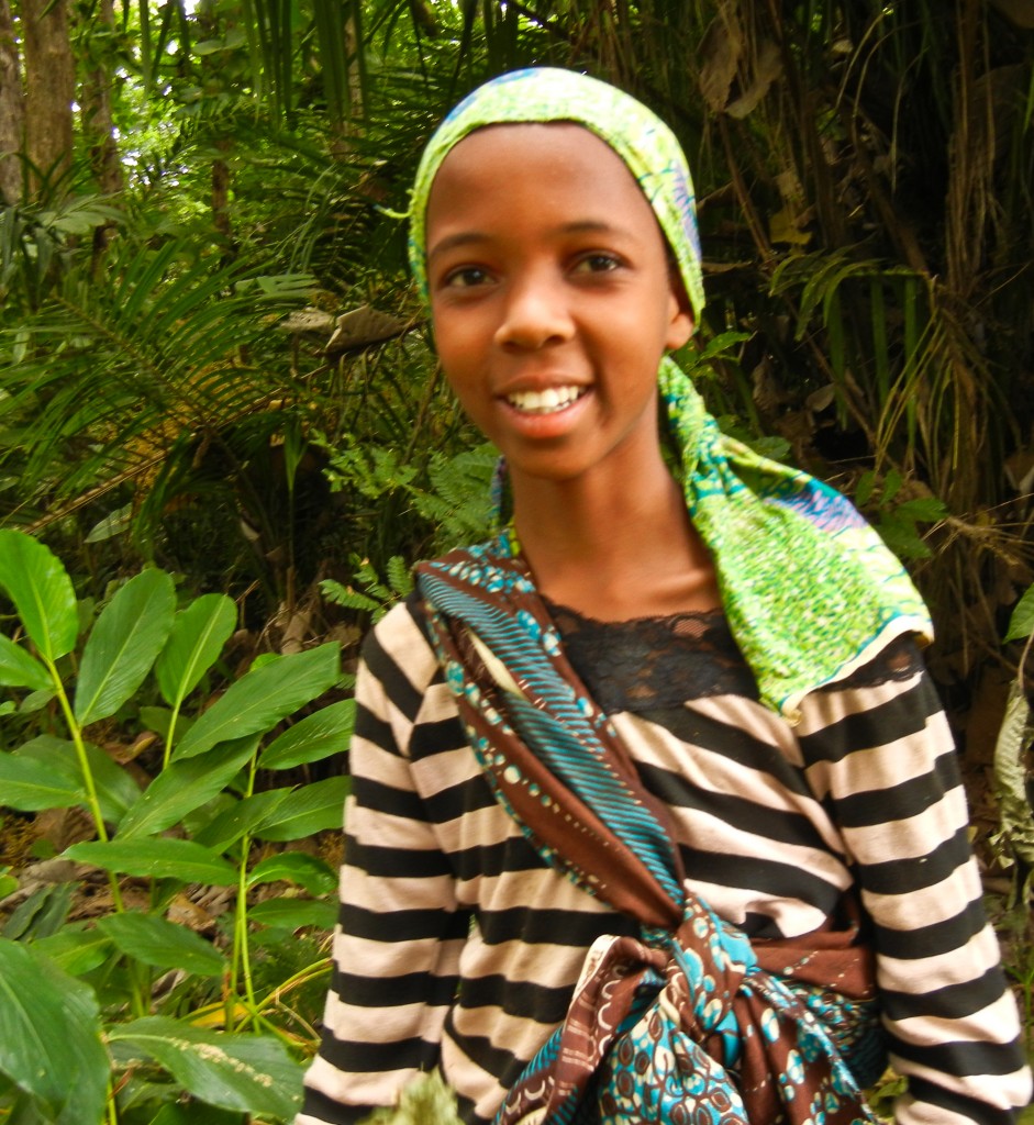
Local girl harvesting firewood in the jungle.

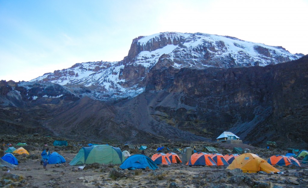
August 9-10.  Our first two days on Kilimanjaro were spent navigating the jungles and ridges of the Umbwe route.  Through light showers and mist, the glaciers of Kilimanjaro would occasionally appear – an inspirational beacon that fueled our progress. In good time we arrived at Barranco Camp (12,926’/3940m), what would be our base camp for two nights.

Team Nguvu Dadas arrive at Barranco Camp!

Morning at Barranco Camp

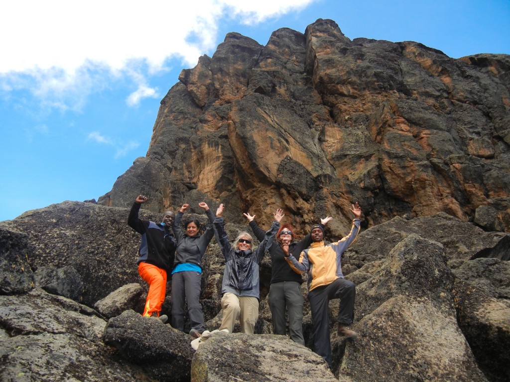
August 11.  The small storm blew through sometime during the night, lightly dusting the the benches of the mountain.  We enjoyed morning tea and coffee underneath a looming Kilimanjaro, our first view of the mountain uninterrupted by clouds or weather.  After breakfast of porridge, fruit, toast and eggs, we walked up to Lava Tower (15,190’/4630m) our high point of the day and Betsy’s personal record.  A hot lunch welcomed us back at camp, and the remainder of the day was spent relaxing, writing, reading, stretching, and napping.

Team celebrates reaching Lava Tower

August 12.  Soon after packing up camp, our team deftly scaled our high point of Barranco Wall then made our way along the south circuit path to Karanga Valley, and up to Karanga Camp (12,893’/3930m).  After cleaning up, we were treated to a hot lunch of fries, chicken, vegetable slaw, sliced fresh watermelon and oranges, and pineapple juice.  The sun broke up a lower cloud layer, which allowed stunning views of Mt. Meru and villages surrounding the base of Kilimanjaro.

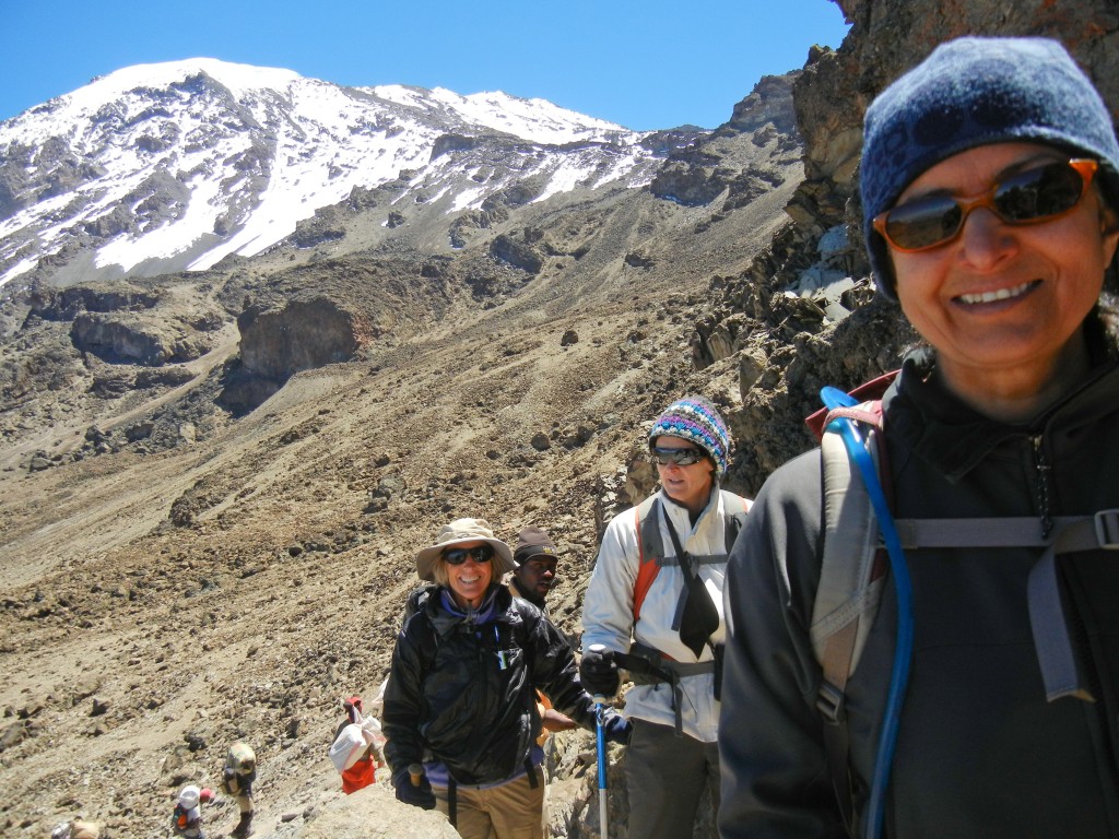
Team navigates Barranco Wall

Sunset over Mt. Meru from Karanga Camp.

August 13.  We broke camp and made good time moving to our high camp, Barafu (115,091’/4600m).  After a hot lunch, we prepared for tonight’s summit bid.  Many international climbers were staged here and the camp buzzed with excitement.

Advancing to Barafu Camp

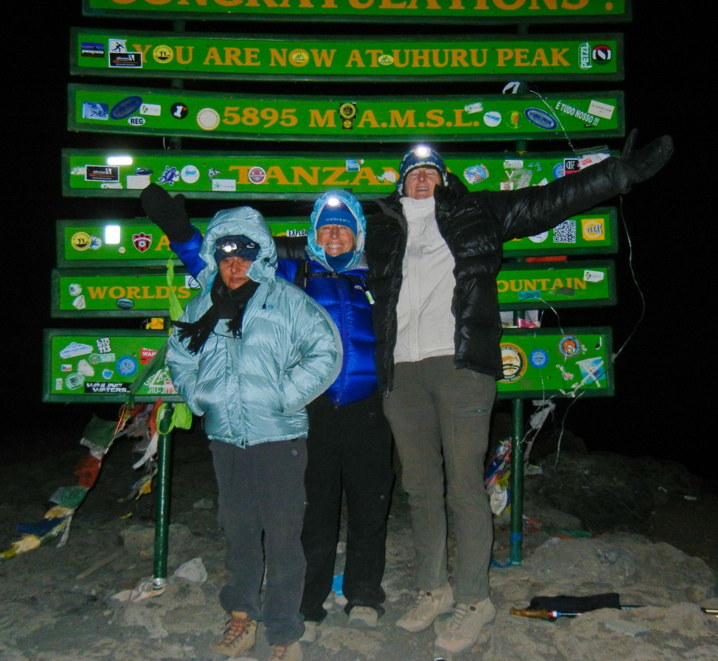
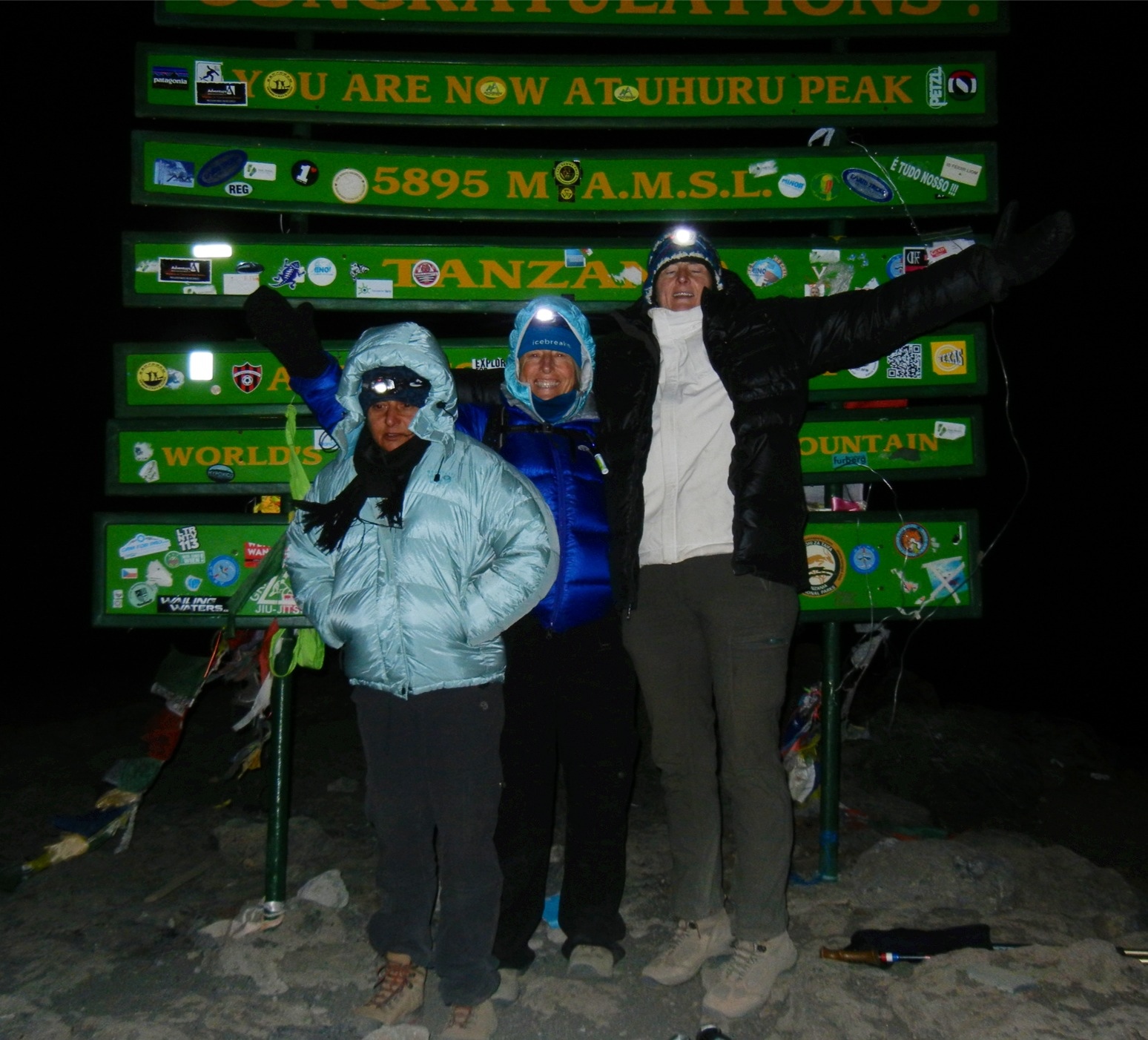
August 14.  We headed off into the night, a stream of headlamps breaking up the blackness, a small but very strong climbing team! We passed many parties on the way as we hiked underneath a brilliant starry sky.  At 5:45AM our team reached Uhuru Peak (19,340’/5895m), the summit of Kilimanjaro! After arriving back at Barafu Camp, we enjoyed a hot breakfast before packing up camp and descending down into the oxygen-rich jungle to Mweka Camp (10,170’/3100m).

Uhuru Peak

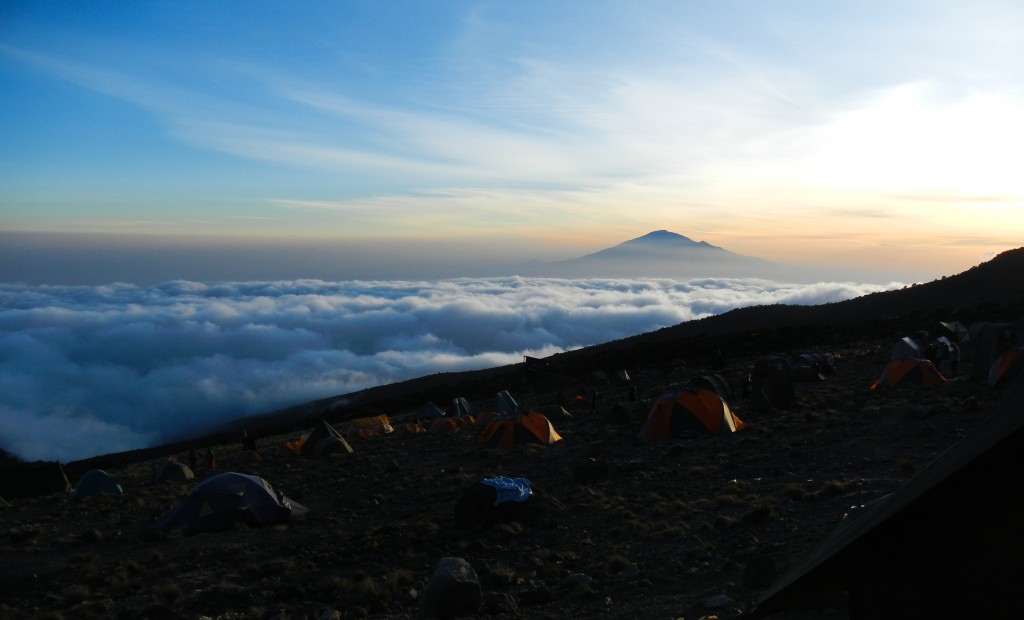
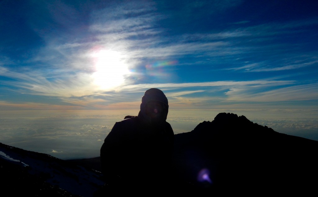
Sunrise view from Uhuru Peak overlooking Mawenzi

August 15.  In the morning, the local staff that supported our climb sang farewell to the team.  After many hugs, we separated and made our way down to Mweka Gate, where our transport waited to return us to Moshi for an afternoon of well-deserved R & R!

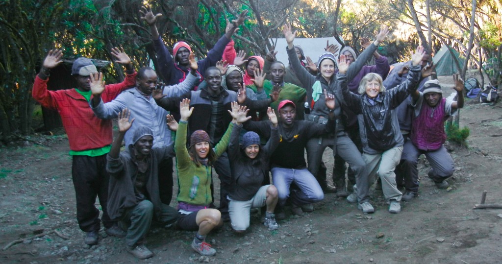
Mweka Camp: Farewell song & dance

The entire photo gallery from our climb of Kilimanjaro can be found here:

http://www.kurtwedbergphotography.com/International-Expeditions/Africa/Kilimanjaro-August2012/24784429_Gd7SHf

SAFARI!!!

The following days, Amber, Rachel, Betsy and April went on Safari while Kelly remained in Moshi donating her time at two local children’s homes.  Her presence was missed on safari!

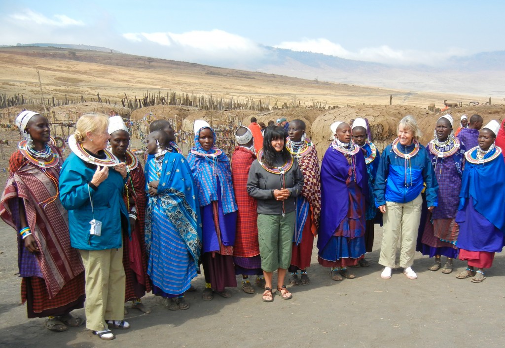
Over the course of five days the team visited Lake Manyara, the Ngorongoro Crater, Tarangire National Park, and the great Serengeti Plains.  In addition to seeing a wide range of exotic wildlife our safaris are also a rich cultural experience.  We spent some time a local orphanage near that has become a traditional stop on our trips.  We also visited a local Masai Village where we were treated to traditional Masai dancing ceremonies, saw the mud huts they live in, and we were given the opportunity to purchase jewelry items.

Wildlife was prevalent throughout our safari.  Below are a few pictures.  The entire photo gallery can be found here:

http://www.kurtwedbergphotography.com/International-Expeditions/Africa/Safari-August-2012/24924709_W34VCq

Rachel, Amber, and Betsy dance with Maasai women

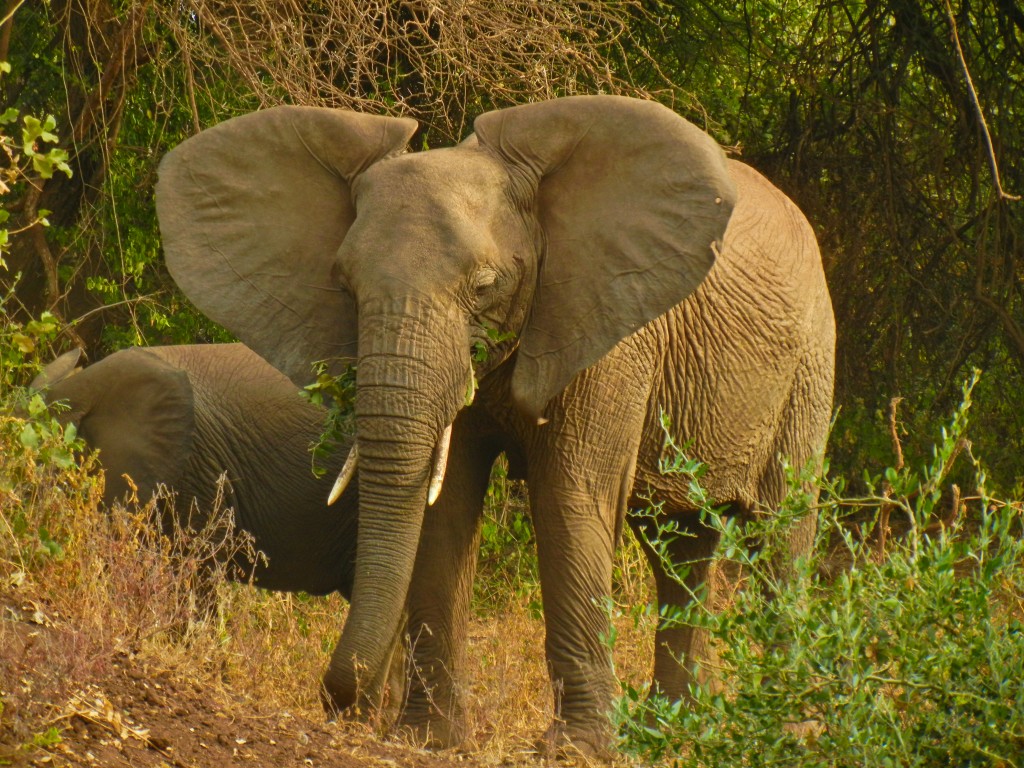
African Elephant (Tembo)

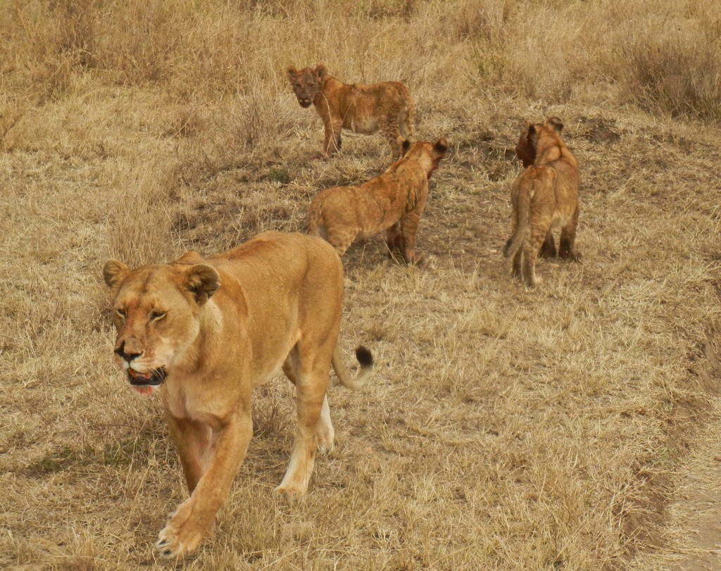
Female lion and cubs after feeding.

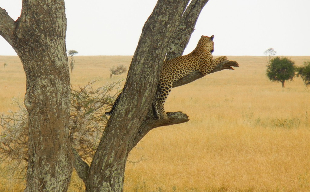
Leopard hanging from tree in the Serengeti

Summit Success on Mt. Elbrus (18,510’/5642m), Russia!!

August 12, 2012, 10:45am: Summit photo on Mt. Elbrus (18,510'/5642m). Left to right: Bob, Joe, and Joey Szalkiewicz, Gia Ksnelashvili. Kneeling in front SMI guide Kurt Wedberg. Congratulations team on a job well done!!

This is a write up of SMI’s 2012 Mt. Elbrus climb as told by SMI guide Kurt Wedberg:

Greetings from the Baksan Valley deep in the heart of the Caucasus mountain range in Russia near the border of Georgia!  We are proud to say our team reached the summit of Mt. Elbrus (18,510’/5642m) on August 12, 2012 at 10:40am!

We have been guiding climbs of Mt. Elbrus since 2000.  Out of all the times I’ve been here this was the most touch and go with the weather.  It has been stormy since our arrival.  It has rained every day in the valley and Mt. Elbrus has received 1-2 feet of new snow on its upper flanks over the past few days.

When we arrange Mt. Elbrus climbs we build in extra days for weather into our itineraries.  We’ve never missed reaching the summit and part of the reason for that is having enough extra days to work with.  This year I was carefully watching the weather patterns and analyzing five different weather forecasts on a daily basis.  They were all calling for stormy weather for the entire time we were here.  It looked like the best break we would have was on Sunday.  Although not ideal it looked like that could be the only day we would have a realistic shot.  The problem was we didn’t have as many acclimatization hikes done as I would have liked.  The human body generally can acclimatize at about 1000’/300m per day above 10,000’/3048m.  We had taken a couple hikes and by Friday we had reached 13,320’/4060m.

This year’s climb was a private expedition with the Szalkiewicz family who are long time good friends of SMI.  Joey and Brittany Szalkiewicz are two of the youngest to ever reach the summit of Kilimanjaro (19,340’/5895m) when they climbed it with us in June 2010 at the ages of 12 and 10 respectively.  On this climb Bob, Joe, and Joey were the team members.  They had trained a lot for this climb and it showed as they had been performing well on all our hikes here.  Although Mt. Elbrus is lower in elevation than Kilimanjaro it is a more physically demanding climb but one I believed they were ready for.

On Saturday we hiked up to 15,500’/4724m.  We did it after arriving at the Diesel Hut (13,320’/4060m) prepared to spend several days if necessary.  After this hike we returned to the hut and I asked each of them how they were feeling… headaches, loss of appetite, general lack of energy, or any other sign of altitude sickness.  Everybody felt great so I told them I’d like to try for the summit the following day.  I cautioned them this was a very aggressive schedule but since they had been diligent in their training and were all feeling well I thought it best that we should jump on the weather while we had a chance.  If we missed the summit because of weather we’d still have a couple days to work with.  In reality though I wasn’t sure we would be presented with another weather window.

Summit day was cloudy and windy but I thought we should stick our noses in it anyway and see what happens.  We strapped crampons to our boots and at 4:30am began our ascent wearing several layers of clothing, headlamps, and goggles to protect our eyes from the blowing snow.  Wind and whiteout conditions were the dominant themes of the day but it never was enough to make us turn around.  We maintained a steady even pace everybody was able to keep.  We took short efficient breaks along the way.  With careful pacing and very little time spent standing around we were able to maintain warmth and keep our bodies fueled.  The wind stayed at a steady 30-40 mph all day.  Occasionally the clouds would part enough to give us a glimpse of the mountain but most of the day our visibility was limited to 45m/150’ or less.  As we neared the summit the wind kicked up harder to a steady 40 mph with gusts to 50 mph.  All team members were wearing five layers of clothing including our puffy down jackets.  6 hours 10 minutes after we started the climb we stepped out on the summit at 10:40am!

Once at the summit we took a couple quick summit photos then it was time to turn around and retrace our steps.

We managed to sneak in the summit finding a small seam in the weather that allowed us to get up and down.  The weather got worse later in the day.  On the following day (Monday) many groups who didn’t try on Sunday made an attempt and nobody reached the summit.  Now back at our hotel in the Baksan Valley it rained for a large part of the afternoon.

Besides finding a seam in the weather the success of this climb is attributed to the team showing up in great shape from many months of diligent training.  They also were careful to always take care of themselves and they did well listening and following instructions.  It was a very memorable climb for all us and I’m very proud of the team’s efforts.  Congratulations Bob, Joe, and Joey!!

A few pictures are below.  The rest of the pictures can be found here:  Mt. Elbrus August 2012

Mt. Elbrus on the morning of August 9, 2012. This was the only view we had of the mountain during our entire trip. Soon after this photo was taken clouds formed around the peak obscuring our view.

Joe, Joey, and Bob Szalkiewicz, and SMI Kurt Wedberg with Mt. Elbrus behind during our first acclimatization day hike.

Our first acclimatization day hike is up Chegit Mtn. located a short distance from Russia's border with Georgia.

Wildflowers are abundant on the flanks of the Baksan Valley during the summer months. The photo gallery from this trip (see the link above) shows many more.

Nearing the high point of our first acclimatization day hike on Chegit Mtn (3400m/11,154') with the Baksan Valley far below.


Lamb kebab's barbecuing over a bed of charcoal coals in the Baksan Valley.

Hiking in the fog during an acclimatization day hike on the flanks of Mt. Elbrus.

Arriving at the Diesel Hut (4060m/13,320'), our high point for this acclimatization day hike. We had lunch then descended back to our hotel. The next day we returned to the Diesel Hut to sleep. Climbing high and sleeping low is one of the best ways to acclimatize to higher elevations.


August 11, 2012: The team at the high point (4725m/15,500') of the last acclimatization hike before attempting the summit on the following day.

Afternoon clearing reveals a nice view of the Caucasus the day before our summit bid.

August 12, 2012, 4:30am: The team beginning the ascent of Mt. Elbrus bundled up with blowing snow and cold temperatures.

At sunrise the team pauses for a quick break for food and water. Clouds obscured the sun for most of the day but occasionally a "sucker hole" would allow sunlight to reach the team.

The team climbing at 5300m/17,388' at 9am about 1 1/2 hours before reaching the summit.

August 12, 2012, 10:45am: Team summit photo left to right: Bob, Joe, and Joey Szalkiewicz, and SMI guide Kurt Wedberg.


Mt. Elbrus Team Arrives Safely!

Greetings from the Baksan Valley deep in the Caucasus mountains at the border between Russia and Georgia!  On August 8 our team arrived here after spending time sightseeing in St. Petersburg the team flew south to the town of Mineralnye Vody then drove to the town of Terskol where we will base ourselves out of for our climb of Mt. Elbrus.  Our hotel is at 2100m/6889′.  This is a very pretty area with pine trees, a glacial fed river, and green hillsides displaying many varieties of wildflowers.

On August 9 we took our first acclimatization day hike.  We hiked to Chegit Mtn at 3400m/11,154′.  This made for a nice first day hike.  After several days of traveling and sightseeing it was nice to get outside and get a nice hike under our belts.  We had a nice view of Mt. Elbrus in the morning before clouds obscured our view of it.  We hiked for 3 1/2 hours to the top of Chegit Mtn.  Weather was pleasant which allowed us to take time to relax and enjoy the view while having  a snack.  Afterwards we descended back to our hotel.  There are a couple ski lifts on this mountain that operate in the summertime.  We took advantage of those and rode them back down to where we started our hike!

On August 10 we completed our second acclimatization hike getting to 4060m/13,320′ on the flanks of Mt. Elbrus.  The team did well and we’re now ready to move up and sleep at the Diesel Hut at 4060m/13,320′.  We plan on acclimatizing to higher elevation once we’re settled in the hut.  This will be our base of operations from where we’ll make our summit attempt.  Currently the region is experiencing evening thundershowers but the forecast is calling for a clearing trend.  Since we can’t control the weather we plan to get ourselves ready physically and mentally if/when weather allows for a summit attempt.

We will post updates and pictures when possible but given the limited internet access in the region it may be a couple days before we check in again.  Thanks for all the support from family and friends back home and we look forward to being in touch soon!!


SMI Guides Ready to Travel!

Kilimanjaro (19,340'/5895m) rising high above the African plains.

We’re in the middle of a busy season here in the Eastern Sierra.  While trips continue to run in this beautiful mountain range we’re fortunate to call our back yard, we also have been preparing for our next international destinations.  On August 5 SMI guides April Mayhew and Kurt Wedberg left LAX bound for other continents.  April will be returning to Kilimanjaro to lead a climb and Game Viewing Safari.  This is an absolute trip of a lifetime!  A 7-day climb of one of the most famous mountains on our planet combined with a safari where it is possible to see some of the most legendary wildlife in the world!

A lioness in a tree near the Ngorongoro Crater, Tanzania.

Meanwhile Kurt is headed to Russia to guide a climb of Mt. Elbrus (18,510’/5641m) which is the highest mountain on the European continent.  Due to local unrest in the area the Russian government cut off access to the area by tourists and climbers last year.  Things have settled down there now and we’re very excited to be offering this climb once again!

We will do our best to log updates on our progress.  If we don’t find good internet access you’ll hear from us upon our return!

Mt. Elbrus's East and West summits. The higher of the two is on the left side of the photo.

St. Basil's Cathedral on Red Square in Moscow.


Everest Expedition Wrap Up

Reuniting with friends, family, and loved ones is an important part of an expedition. From left to right: Fred Simmons, Fred's daughter Carolyn Simmons, and Kurt Wedberg. Carolyn got to witness first hand Fred and Kurt taking care of food cravings at a restaurant in LA!

Our Spring 2012 Everest Expedition is now over.  Fred and I managed to get up to the summit and back down in one piece.  It was a great life adventure like no other.  Like all big expeditions it will take some time for the full magnitude of what we accomplished to sink in.  For now we are fortunate enough to be in the position to enjoy every moment of that process.  We landed at LAX on May 24.  After a nice afternoon nap we worked on our first of many food cravings by getting dinner at a local burger joint called The Counter.  These huge burgers are made to order and loaded with mounds of toppings!!  This sent us into a satisfying food coma and soon we were back catching up on much needed sleep.  Climbing Mt. Everest takes a lot out of a person both physically and mentally.  Since we were standing on the summit only a week ago it’s understandable that our bodies are craving much deserved rest and a replenishment of calories!!

We have been asked a lot about our summit day.  For those interested here is a brief synopsis of how the day went:

The summit push took us seven days in total from Base Camp back to Base Camp.  We stayed right with our original projected schedule:

May 15:  Climb from Base Camp to Camp 2 (6495m/21,309′)
May 16:  Rest at C2
May 17:  Climb from C2 to C3 (7406m/24,300′)
May 18:  Climb from C3 to C4 (7955m/26,100′)
May 19:  Summit Day, return to C4
May 20:  Descend from C4 to C2
May 21:  Descend from C2 to Base Camp

After resting at C2 on the 16th it was time to move up to C3.  This begins the summit push in earnest.  As one moves into this rarified air the human body takes a toll.  If weather forced us to retreat it would take several days for us to recover sufficiently to try again.  We left C2 at 4:30am.  The route took us up the Lhotse Face, which is about 30-45 degrees in steepness.  Our goal was to get high on this face en route to C3 before the sun hit us.   Upon arriving at C3 we slept on oxygen overnight.  This gave our bodies a chance to recover.  On May 18 we woke early and began the climb to C4 at 7am.  Our route continued up the Lhotse Face then crossed left through the yellow band of shale.  After ascending the yellow band we traversed onto a rock promontory known as the Geneva Spur.  Topping out on the Spur the route then leveled off as it headed to the South Col where C4 is located.

After arriving at C4 at 1pm our goal was to relax and prepare for our summit push.  We relaxed on oxygen and made sure our rucksacks were packed.  We were planning to get an early start so every bit of rest we could get now would be important.  In the rarified air at C4 everything we did was a chore.  Although we had burned lots of calories and were hungry the act of digesting food was extremely difficult.  We did our best to hydrate and eat food though, which would be critical for our climb.

At 7:30pm we started getting ready.  We put on our climbing harnesses, boots, and crampons while wearing headlamps.  We shouldered our rucksacks each filled with an oxygen bottle and at 8:15pm we began our ascent.  Weather was cold with a steady wind blowing 20-30mph.  Many other headlamps could be seen ahead of us on the route.  Soon we were attaching ourselves to the fixed line that was anchored the previous day by an advance team of Sherpa’s and we settled into a rhythm of 3-4 deep breaths for each step we took up hill.

With no moon we had a blanket of stars above us but were aided very little in the way of light.  The beams of our headlamps illuminated our path a few feet in front of us, which proved enough for what we needed to see.  The terrain was mixed snow and rock angling at a steady 30-40 degrees.

After several hours of steady climbing we found ourselves topping out at a feature known as the Balcony.  Here we changed out our partially used oxygen bottles for fresh cylinders.  Wind speeds had picked up and we found ourselves covering our faces from the 40mph steady breeze that occasionally gusted to 50mph.  At 2am we shouldered our rucksacks once again and continued our ascent.  The route follows a ridgeline with steep drop offs on either side.  This leads to some rocky steps that have to be surmounted while wearing heavy gloves and crampons strapped to our boots.  Trying to keep a steady rhythm we maintained a solid 4-5 breaths for each step.  After 3 hours of climbing we found ourselves high up on Everest as light began to illuminate the eastern sky.  Above us was the South Summit of Everest.  Once we gained the South Summit the route descends slightly then follows a ridgeline to the actual summit.

It was right about this time that one of Fred’s crampons broke.  A piece had come off that held the front and back halves of the frame together.  Without this piece the crampon was rendered useless.  We stopped at an anchor point for our fixed line and examined the frame.  There was some older line still present from a previous year.  We took out a knife and cut some strands of this rope.  We then used these strands to attempt to tie the two halves of the crampon frame back together.  If it worked then Fred should be able to climb OK.  If not, I decided to give one of my crampons to Fred and have him continue on to the summit with our Sherpa Kancha Nuru.  I would then wait for their return.  Thankfully the rope held the frame in place and we continued on to the South Summit.

At the South Summit we made one more change in Fred’s oxygen.  At a standard flow rate of 3 liters per minute two oxygen bottles is enough to get up and down Everest assuming no unnecessary delays occur.  With a third bottle Fred was able to kick that up to a 5 liter flow.  This proved especially helpful on such a cold day.  Armed with a fresh bottle for Fred we continued on towards the summit of Everest.  The terrain gets more rocky in this area and eventually leads to the Hillary Step, the crux of the climb.  It is not difficult but it is about 40 feet of hands over feet rock climbing with sheer drop offs in both directions.  Clipping in to a new fixed line we climbed up and surmounted the Hillary Step one at a time.  Above the step the terrain turns into a gradual ridgeline leading to the summit.

After over 12 hours of climbing including a few delays along the way there was no higher point to climb.  Two months of hard work and effort had culminated in us reaching the highest point on our planet!!

Now we are back stateside and recovering nicely.  We have been tackling our many food cravings one by one.  It is a time of reflection and reconnecting with friends, family, and loved ones.  Climbing Everest has a way of humbly helping us gain a new rich appreciation for all we have in this world.  As we move forward through the coming days and weeks we plan to savor every minute of this process.

One thing we are thankful for is everybody who followed along on this blog and kept us in their thoughts and prayers.  It has been a joy to hear from so many of you and we look forward to continuing that process.

All the pictures we took during this expedition are now uploaded on to the SMI Photo Gallery web site.  For your viewing pleasure we invite you to look at them here:  http://www.kurtwedbergphotography.com/International-Expeditions/Himalayas/Mt-Everest-Spring-2012/23167265_3Zt2mR

May 18: Fred traversing off the Lhotse Face at approximately 25,500'/7772m.

Fred and Kancha Nuru Sherpa topping out on the Geneva Spur at approximately 25,900'/7894m as early afternoon snow flurries blow through.

Camp 4 at the South Col 7955m/26,100'.

Mt. Everest's South Summit is the highest point on the skyline. The actual summit sits behind the South Summit.

Fred and Kancha Nuru geared up and ready to begin the ascent to the summit.

May 19, 2012 9am: Summit Success!! Fred and Kurt on the top of Mt. Everest!!


Everest Team Down Safely!

May 19, 2012 9:00am: Fred Simmons and Kurt Wedberg on the summit of Mt. Everest (8850m/29,035').

After a successful summit of Mt. Everest on May 19, Fred and Kurt safely descended back to Base Camp.  The descent took two days.  They dropped from Camp 4 to Camp 2 on May 20.  On the 21st they woke early and descended through the Khumbu Icefall, which was the last of the objective hazards on the route to negotiate.

Once down in Everest Base Camp they quickly packed up all their gear and managed to secure a helicopter that flew them from EBC to Kathmandu.  Flights are re-booked for traveling home. Projected arrival in Los Angeles will be on the 24th.

Upon re-entering civilization and seeing all the comments on this blog plus all the messages on our emails and Facebook pages it has been heart warming seeing what everybody has written.  We promise you every single comment will be read if it hasn’t been already!!  We will do our best to respond as soon as we can!!

For the moment we are concentrating on having some good meals and doing our best to rehydrate.   It is difficult for us to believe at the moment that three days ago we were standing on top of the world!  We will be posting a report on summit day soon.  Stay tuned for that…

Thanks again for everybody’s prayers and well wishes and we look forward to being in touch again soon!!