Category: SMI News

Aconcagua, December 7

The team left the Vacas valley trailhead on Dec 2 and had a beautiful 3 day hike into Aconcagua base camp at 13,747 feet

On Dec 5th we rested and acclimated and on Dec 6 we took our first acclimation day hike to 15300 feet.

Dec 7th we carried loads to camp 1 at 16,700 feet

Tomorrow our plan is to move up and sleep at camp 1.

Everybody on the team is doing great we miss everyone at home. Bill Fred and Ralph say hello to their spouses Cindy Olga and Danielle

Thanks you everybody for your thoughts and prayers

We will update again in a couple days.

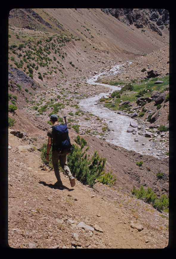
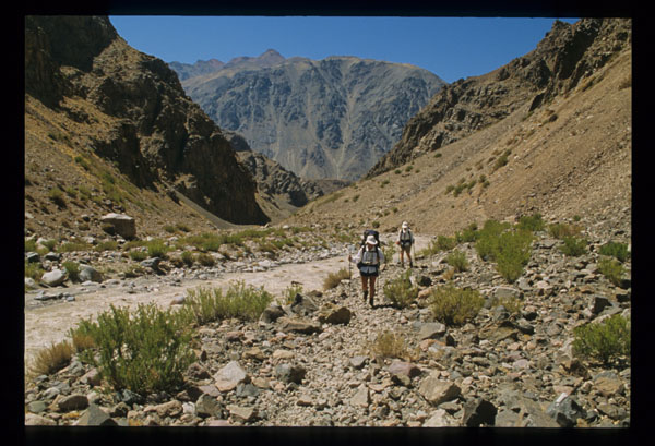
The team will venture up the Vacas Valley for the next two days. The Vacas River is a glacier fed river that has its origins at 18,000+ feet on the flanks of Aconcagua.

Our trail sometimes goes right next to the river and sometimes climbs above it offering pretty views of the winding Vacas River below. The color of the river is made from silt that comes from the glacier where the river begins.

The lower part of the Vacas Valley is decorated with many pretty wildflowers along our trail.

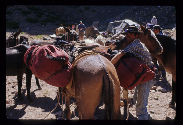
The mules arriving at Camp 1.

Aconcagua, December 1

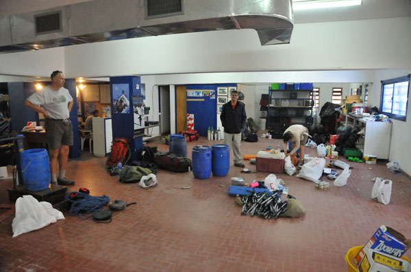
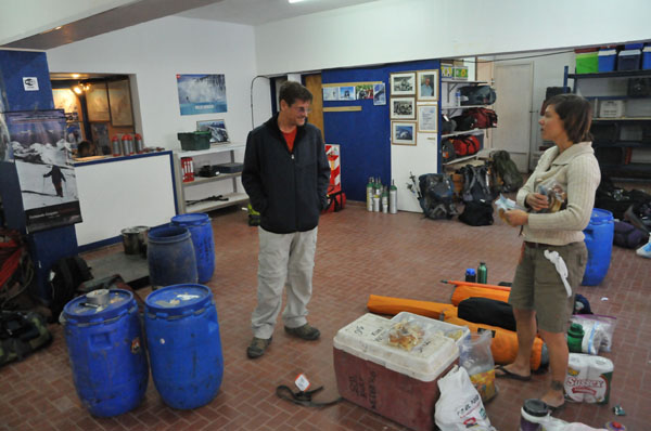
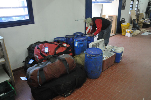
This morning the team had breakfast then packed up and drove from Mendoza to the resort village of Los Penitentes located at 8465’ / 2580m.  The drive took approximately three hours.  Upon arrival we spent the afternoon organizing all our food and equipment for the trek into Base Camp.  The trek will take three days to reach Base Camp at 13,747’/4200m.  Our equipment needed to be packed into loads to be carried by mules onto the mountain.

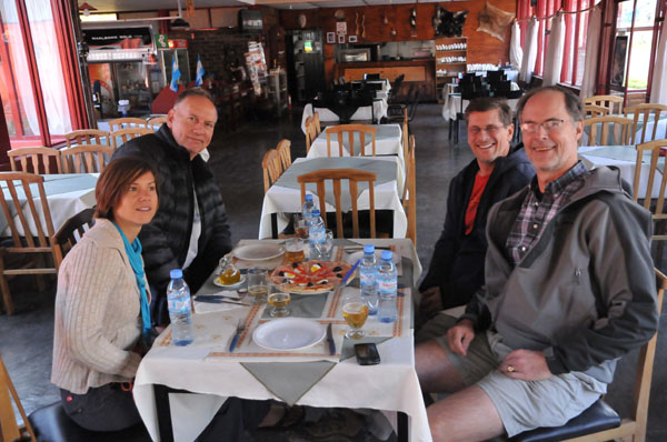
After finishing all our organization and packing we had some time to relax before having dinner.  The team enjoyed a nice pizza and salad dinner.

After all the planning and preparation leading up to this trip the time has come to start our climb.  We are all psyched and ready to start walking!!

Thanks to everybody for at home for your prayers and support.  We will try to update this blog when we can.

A couple pictures from today are below.

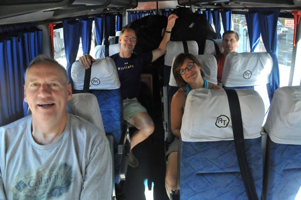
The team loaded up and ready for the drive from Mendoza to the resort village of Los Penitentes at the base of Aconcagua.

Los Penitentes

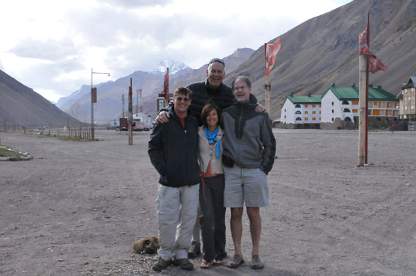
The team in Los Penitentes

Ralph, Bill, and April in the midst of organizing our gear for the mountain. All our equipment needs to be divided into loads that will be carried by mules for the 3-day trip to Base Camp

Bill and April discussing final load preparations.

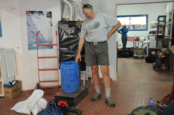
Ralph loading barrels with our food and equipment that will be carried by mules into Base Camp.

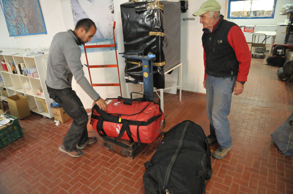
All our loads are carefully packed so each piece weighs between 20-30 kilos.

The teams equipment and food for the next 2+ weeks on Aconcagua packed and ready to go!!

With all our gear packed the team enjoys a nice meal of pizza and salad.

Aconcagua November 30 – The team has arrived in Mendoza, Argentina!

The team arrived in Mendoza, Argentina today after leaving on flights that originated in the United States yesterday.  The flights took us to Santiago, Chile where we changed planes for a quick flight over the Andes to Mendoza.  April and Kurt arrived yesterday and spent the day taking care of last minute logistics and purchased food for the expedition.  Today they finished up logistics then went to the airport to meet Bill, Fred, and Ralph for their arrivals.  After getting settled in the hotel we payed a visit to the Ministry of Tourism where we secured our climbing permits.  It is now required for every team member to be present to receive your climbing permit.

With permits secured we had time to relax in this laid back South American city that strictly observes such rituals as “siesta”.  Virtually all merchants are closed between 1:30 – 5:30 PM.  Siesta provided a nice time for the team to relax at an outdoor cafe and enjoy appetizers and a drink while soaking in the afternoon sun.  Temperatures are pleasant this time of year allowing us to comfortably wear shorts and t-shirts even in the evening.

We ate dinner across from La Plaza de Independencia and took a stroll through the park before retiring to bed.

Tomorrow we will drive to Los Penitentes, which is a resort village located at the base of Aconcagua.  Here we will unpack our luggage and prepare our food and equipment for the climb.

A couple pictures from the day are below.

April, Ralph, and Fred at the permit office in Mendoza.

Ralph, Bill, and Fred checking out our route at the permit office in Mendoza.

With the permit process complete the team relaxes at an outdoor cafe in Mendoza.

Bill enjoying relaxation and good conversation in Mendoza.

Ralph

Fred

A neon sign in La Plaza de Independencia in the heart of Mendoza welcomes us.

Dinnertime Mendoza style. Outdoors and enjoying the summertime evening we toasted to a nice trip with anticipation of many memorable adventures ahead.

April sampling a glass of famous Mendoza wine while enjoying good conversation at dinner in Mendoza.

Lit up fountains decorate La Plaza de Independencia at night in Mendoza.

The team enjoying an after dinner evening stroll through La Plaza de Independencia.

Aconcagua December 2010 – We’re on our way!!

Our first Aconcagua expedition for the 2010/2011 season is on its way!  Ralph Drollinger, Fred Simmons, and Bill Simon will be joined by April Mayhew and Kurt Wedberg.

The team will fly from the United States and meet as a group in Mendoza, Argentina on November 30.  After securing climbing permits we will drive to Los Penitentes where we will organize our gear to be carried by mules for the 3-day trek into Base Camp.

The team spent the last couple of days organizing last minute details in Los Angeles before flying.

A couple pictures are below.  Stay tuned for updates to our expedition!!

The team having fun shopping for last minute items at Adventure 16 in West LA. From left to right: Ralph Drollinger, Kurt Wedberg, Alia Mohsenin (A16's stellar veteran salesman and expert boot fitter), Bill Simon, and Fred Simmons.

Ralph needed specially modified crampon to fit his size 17 boots. A metal expert designed extra long bars to give the crampons enough length. Kurt and Ralph used material purchased at Adventure 16 to manufacture straps that were long enough to fit around the boot.

o

Bill Simon doing his best Maxwell Smart agent 86 imitation with one of Ralph's crampons turned "crampon phone".

The team in Bill Simon's office organizing personal equipment for the climb.

Bill and Kurt in Bill Simon's conference room turned gear packing room discussing equipment selection for this expeditions

Kurt and Ralph with Denni Cohen. Denni is Bill's #1 administrative assistant and came in to double check that all final details were taken care of before we left. Thanks Denni!!

Ralph and Danielle Drollinger inspecting one of the expedition tents.

After finishing shopping and packing for the expedition Ralph Drollinger questioned the regulation height of Bill Simon's basketball court.

April Mayhew making sure we don't miss Ralph's arrival at the Mendoza airport!

First lunch in Mendoza!

Mexico’s Volcanoes November 5-14, 2010

Orizaba from the the rural countryside above the town of Tlachichuca.

Our yearly trip to Mexico’s Volcanoes was another huge success.  We climbed two volcanoes in a 10 day period, visited the pyramids at Teotihuacan, and got to experience the warmth and hospitality of the Mexican people.

This trip was also used as a fundraiser for Big City Mountaineers.  This organization takes underprivileged urban teens on seven and eight day backpacking trips during the summer months.  They hold a series of climb each summer the call Summit For Someone which raises money for Big City Mountaineers.  SMI has worked with Big City Mountaineers since they began doing fundraising climbs.  We lead several trips each year for this worthy organization.  Besides Mexico’s Volcanoes we also lead climbs to Mt. Whitney, North Palisade Peak, and Mt. Langley each year for BCM.  In February 2011 we will also be leading one to Kilimanjaro!!

The Team on an acclimatization day hike below Iztaccihuatl. From left to right: Kurt Wedberg, Kyle Gerecke, Bret Siciliano, Brandon Kibby, JP Latkovic, Jason Cahill, Miriam Diaz

After meeting up in Mexico City we drove to the town of Amecameca which sits at the base of our first mountain Iztaccíhuatl (17,158’/5230m).  A couple days of acclimatization hikes would put us in to position for a summit attempt on “Ixta”.  Iztaccíhuatl is the name the Aztec’s gave this mountain, which translated means “white woman”.  This mountain resembles a women laying on her back when viewed from a distance.  “White” refers to snow that covers the upper reaches during certain parts of the year.

Iztaccihuatl 17,158'/5230m

We ascended “The Knees Route” which climbs past Ixta’s knees onto her belly where the summit is located.  On summit day we were treated to a clear crisp morning.  Snow conditions were excellent.  We got a predawn start and found ourselves high on the peak as the sun rose giving us a beautiful backdrop as we ascended the partly snowy and rocky terrain that leads to the summit.

Kyle, Bret, and JP navigating the terrain on summit day on Iztaccihuatl.

The lights of the city of Puebla shortly before sunrise. The early morning light silhouettes El Pico de Orizaba in the distance.

Kyle and Brandon climbing the ridge at sunrise high on Iztaccihuatl.

Miriam, Bret, and JP climbing the "belly" high on Iztaccihuatl.

Miriam, Bret, and JP traversing the summit ridge of Iztaccihuatl at 7:10 AM

Summit photo on Iztaccihuatl November 9, 2010 7:30 AM

After successfully reaching the summit we descended back the same way with views of neighboring volcano Popocatepetl in front of us and our next objective Orizaba visible to the east.

The team descending Iztacchuatl pauses to view our next objective: El Pico de Orizaba. We would be standing its summit three days later.

An iron cross with Popocatepetl in the background. Crosses have been placed on most of Mexico's volcanoes by the Grupo de los Cien (The group of the 100) made up of Catholic priests who are mountaineers.

Orizaba is the highest mountain in Mexico and the third highest in all of North America at 18,410’/5611m.  Only Mt. McKinley in Alaska (20,320’/6194m) and Mt. Logan in Canada (19,550’/5959m) are higher than Orizaba on this continent.  It is a classic cone shaped volcano flanked by glaciers on all sides.

Our team drove south and east to the small town of Tlachichuca near the base of El Pico de Orizaba.

The team in Tlachichuca at the base of Orizaba.

Here we geared up and took a 4-wheel adventure drive through the rural Mexican countryside then ascended through pine tree forests before emerging above timberline to the Pierdra Grande Hut at 14,000’/4267m.  Our route was the Jamapa Glacier that ascends the cone’s north side to the crater rim.  We traverses a short distance west to the highest point on the rim.

Orizaba from the rural countryside below.

The team fired up and ready for the pre dawn start of our ascent of Orizaba.

Kyle, Brandon, and JP climbing high on summit day with Orizaba casting its morning shadow on the rural Mexican countryside thousands of feet below.

View looking North East towards the Gulf of Mexico from 17,500'/5334m on Orizaba.

Bret, Jason, and Miriam pausing for a break at the crater rim on Orizaba.

JP, Brandon, and Kyle at the crater rim of Orizaba.

Our elated team having just reached the top of the 3rd highest mountain in North America.

Proudly displaying the Big City Mountaineers flags the team gathers for a photo on summit of Orizaba. Back row: Jason Cahill, JP Latkovic, Miriam Diaz, and Bert Siciliano. Front row kneeling: Kurt Wedberg, Brandon Kibby and Kyle Gerecke.

After our climbs the team drove back to Mexico City by way of the Teotihuacan pyramids.  Teotihuacan is located 25 miles north of Mexico City and contains some of the largest pyramidal structures in the Pre-Columbian era.  The pyramids are thought to have been completed between 200 BC and 100 AD and this city is believed to have had up to 200,000 inhabitants at its height in the 7th to 8th centuries.  We took some time to climb the Pyramid of the Sun and the Pyramid of the Moon, see some of the paintings that are still preserved here, tour some of the archeological sites, and walk the Avenue of the Dead.

From the Pyramid of the Moon looking down the Avenue of the Dead with the Pyramid of the Sun left.

The team on top of the Pyramid of the Sun with the Pyramid of the Moon behind.

We then returned to Mexico City for dinner.  We happened to be there during Mexico’s bicentennial celebration.  The center of the city was filled with an elaborate well done light show and music.  Seeing the celebration was icing on the cake to a wonderful and very memorable trip!

Lights during Mexico's bicentennial celebration.

The entire photo gallery can be found here:  Mexico’s Volcanoes November 5-14, 2010
Mt. Gould (13,005’/3964m) November 2, 2010

Mt. Gould is accessed through the beautiful Onion Valley trailhead above the town of Independence.  It is located above Kearsarge Pass along the crest of the Sierra.  This is a fun scramble above the Kearsarge Pass trail that ends at the final summit block where a couple 3rd class moves are encountered to reach the top.

Bruce Millar and Michael Tate are long time friends of SMI and it was a pleasure to see them return for a fall peak ascent.  After a recent storm has left a few inches of fresh snow temperatures warmed up significantly causing most of the fresh snow to melt and give way to dry ground on sun exposed south facing slopes leaving behind only patches in between sections of dirt, rock, and scred.  Warm weather prevailed on this day allowing us to wear short sleeved shirts all the way to the summit of this fun peak.  The views from the summit are spectacular offering vistas deep into Sequoia / Kings Canyon National Park to the west, and Sardine Canyon directly below to the east.

A few highlights are below.  The rest of the pictures can be found here:  Mt. Gould from Kearsarge Pass November 2, 2010.

Left to right: Kurt Wedberg, Michael Tate, Bruce Millar

Heart Lake in Onion Valley.

Mt. Gould on the skyline with the Kearsarge Pass trail below.

Bruce Millar enjoying the climbing high above Kearsarge Pass with Gilbert and Flower Lakes far below.

Michael Tate above Kearsarge Pass with Pothole Lake below.

Two does and three fawns skirting the terrain near us as they cross the crest of the Sierra.

Bruce and Kurt on the summit block of Mt. Gould.

Mike Tate climbing the summit block of Mt. Gould.

Kurt on top of Mt. Gould's summit block.

Thanks for a great climb guys!!

Thor Peak – Stemwinder Route October 29, 2010

The normal erratic fall weather pattern in the Sierra has continued to bring us intermittent warm weather followed by cold snaps and light snow.  Earlier in October as much as 2 or more feet of snow had fallen along the crest of the Sierra.  Warm weather would melt the snow that deposited on sun exposed slopes but anything in the shade has remained.  This made Thor Peak a good choice for a climb.  It is a nice day trip requiring much lighter packs than an overnight trip would and the Stemwinder route is south facing meaning it received a lot of sun exposure so the rock would be free of snow.  Stemwinder is a nice entry level alpine rock climb.  The moves are rated up to 5.5 with easier sections in between.  The rock quality is superb with firm white granite and little loose terrain to be concerned about.

Richard Piotrowski and Kurt Wedberg teamed up to make a nice day of it.  The weather included high clouds and some winds that signaled an approaching storm.  That evening the area received several inches of snow and effectively made this route much more of a mixed climb for the next few months.

A few highlights are below.  The rest of the pictures can be found here:  Thor Peak via Stemwinder October 29, 2010.

Thor Peak's South Face. The Stemwinder route is on the right side of this face.

Richard enjoying the climbing on Stemwinder.

Richard high up on Stemwinder.

Richard and Kurt on the summit of Thor with Mt. Whitney behind Kurt on the right.

Thunderbolt Peak to Starlight Traverse September 24-26, 2010

On September 24-26, 2010 Brian Corrigan and Erik Peterson joined Kurt Wedberg for a climb of a couple classic 14ers in the Palisades region of the Sierra.  Here in the Sierra we were treated to summer temperatures over 10 degrees above normal for this time of year.  On September 24 we hiked over Bishop Pass and camped in Palisade Basin.  On day 2 we got a pre dawn start climbing Southwest Chute #1 on Thunderbolt Peak.  After reaching the summit we traversed south along the crest of the Palisades towards Starlight Peak.  After climbing Starlight we descended back to Palisade Basin for a nice dinner before going to sleep.  On day 3 we retraced out steps hiking back over Bishop Pass to the parking lot at South Lake.

The Palisades from Palisade Basin. Thunderbolt Peak is just out of view on the left. Starlight and North Palisade Peak are above.

Left to right: Kurt Wedberg, Erik Peterson, Brian Corrigan

Brian and Erik taking a break at Bishop Pass (11,972', 3694m).

Kurt climbing the summit block on Thunderbolt Peak.

Brian on top of Thunderbolt Peak's summit block.

Erik atop Thunderbolt Peak.

From the summit of Thunderbolt Peak looking along the Palisade Crest towards Starlight Peak.

Brian atop Starlight Peak

Erik surmounting the "milk bottle" that makes up Starlight Peak.

Kurt atop the "milk bottle" on Starlight Peak.

Norman Clyde Peak (13,920′, 4243m) September 16-18, 2010

Demetria Gianopoulos and Tom Sakowych joined Kurt Wedberg for a climb of the NNE Face of Norman Clyde Peak.  This peak is named after the legendary Sierra mountaineering pioneer.  Norman Clyde taught school in the Owens Valley and lived in Big Pine creek canyon.  This impressive peak is situated just north of Middle Palisade Peak above the glacier that goes by the same name.  The NNE Face is an enjoyable 3rd /4th class route offering good rock quality and great views of the Palisades.  As one climbs higher views looking north all the way to the Minarets and Boundary Peak are revealed.

On day 1 our approach brought us in to Finger Lake.  A pre dawn start on a warm September night got us to the base of the route shortly after sunrise.  After reaching the summit we returned to Finger Lake.  On day 3 we hiked out.

A few pictures are below.   The rest of the pictures are here:  Norman Clyde Peak September 16-18, 2010.

Norman Clyde Peak in morning light. The NNE Face is on the far right side of the sunlit part of the massif.

From left to right: Demetria Gianopoulos, Kurt Wedberg, Tom Sakowych

The NNE Face of Norman Clyde Peak

Demetria at a belay high on the NNE Face of Norman Clyde Peak.

Tom climbing one of the 4th class pitches near the top of the NNE Face of Norman Clyde Peak.

Demetria enjoying some of the 4th class climbing near the top of the NNE Face of Norman Clyde Peak.

From the top of the NNE Face looking south on the ridge line that leads to the summit of Norman Clyde Peak.

Tom and Demetria on the summit of Norman Clyde Peak.

Mt. Russell Mithral Dihedral September 4, 2010

Mt. Russell’s Mithral Dihedral has long been a classic test piece in the Sierra backcountry.  While most of the route is mid 5th class the dihedral in the middle is 300 feet of sustained crack climbing.  A dihedral is a rock formation that resembles a book half way opened up.  The Mithral Dihedral was originally rated 5.9 but the consensus now has it rated closer to 5.10b.  On a beautiful crisp early September morning Darryl, Zach, and Kurt went up to give it a go.  Here are a couple pictures.  The rest can be found here:

Mt. Russell from hear the Whitney / Russell Col

The Mithral Dihedral on Mt. Russell's south face

Darryl geared up and ready to lead the first pitch.

Zach leading the last pitch of the crux dihedral.

Kurt at a hanging belay in the middle of the Mithral Dihedral

Summit photo from left to right: Kurt, Darryl, Zach