Category: SMI News

North Palisade Peak to Mt. Sill Traverse August 23, 2010

After returning to Bishop from a successful ascent of Middle Palisade Peak Ed and Lori took a couple rest days then were back on the trail with Kurt Wedberg headed over Bishop Pass to Palisade Basin.  The goal was to climb four “California 14ers”:  Mt. Sill (14,153’/4314m), Polemonium Peak (14,080’/4292m), North Palisade Peak (14,242’/4341m), and Starlight (14,200’/4328m).  These were the last four 14ers Ed had not yet climbed.

Ed and Lori elected to hire the folks at Rainbow Pack Outfitters to help haul our gear up to Bishop Pass (11,972’/3649m).  This would allow us to carry a light daypack over the 6 mile / 2300’+ distance.  We met at the Rainbow Pack Outfitters headquarters 1.2 miles / 1.9 km below the South Lake Trailhead for a hearty breakfast then we were off to the trailhead to begin our trek on August 20.

Kurt, Ed, and Lori sitting down for a hearty breakfast at the Rainbow Pack Outfitters headquarters.

Weather was clear and warm making for a very enjoyable hike up to Bishop Pass.

Ed, Lori, and Kurt on the Bishop Pass trail.

Ed and Lori enjoying the scenery at Long Lake along the Bishop Pass trail.

Lori, Ed, and Lawrence from Rainbow Pack Outfitters.

Here we put on the big packs and hiked cross country over Thunderbolt Col and down into our camp at Palisade Basin where we met up with another SMI group led by our guide Zach Schneider.  He was with Chad Buelow and John Walsh.  They had just returned from the summit of Thunderbolt Peak (14,003′ / 4286m) and were preparing to climb North Palisade Peak in the morning.  We set up camp, had dinner, and prepared for climbing North Palisade Peak as well.

We got a predawn start on August 21 headed for the LeConte Route on North Palisade Peak.  The day dawned clear and cool as we began ascending the chute leading to the start of the route.  We reached  13,100′ / 3993m where the start of the route is located and took a break to refuel and prepare for the class 3/4 climbing above.  While we took our pause we watched as Zach and John began the traverse across a wide ledge that marks the first moves of this fun route.

John Walsh (left) and SMI guide Zach Schneider on the ledge traverse that marks the start of the LeConte Route on North Palisade Peak.

Ed and Lori then turned to me and indicated they just weren’t feeling ready for climbing this route today.  Those decisions are always difficult to make but all of us as mountaineers have had those gut feelings and it is usually wise to listen to them.  We decided to turn back and return to camp to rest and regroup.  As the day moved in to mid afternoon we spotted Zach and John returning from their successful ascent.

We also noticed an unseasonal chill in the air and clouds building up covering the tops of the peaks.  Bundling up in all our clothing we ate dinner and decided we would look at the weather in the morning to see if a summit attempt would be possible in the morning.  Clouds and cold temperatures remained all night long and were still settled over the mountain tops in the morning so the decision was made to hold off and wait for improving weather.

Clouds covering the Palisades peaks.

We had enough time built into our itinerary to wait and an extra day at our camp at 11,950’/3642m would only add to our acclimatization.  As the morning gave way to afternoon the clouds dissipated and the temperature warmed back up significantly.  Kurt’s altimeter also indicated a solid rise in barometric pressure.  All indications were saying this weather disturbance was passing and favorable conditions were going to prevail.

On August 23 Ed and Kurt left camp wearing headlamps.  Lori elected to stay behind favoring a relaxing day of The goal was to climb North Palisade Peak then traverse south following the ridgeline, rappel into the U Notch Couloir then climb up to the summit of Polemonium Peak.  From there we would continue along the ridgeline to Mt. Sill then return to camp via Potluck Pass.  We accomplished all of this on a warm sunny day that allowed us to wear only short sleeved shirts once we hit the sun.

Ed and Kurt ready for a pre dawn start for the traverse.

After a very rewarding day of climbing three 14ers Ed elected to leave the last remaining  peak on his list for another trip.  Starlight Peak is considered the most difficult of all the California 14ers and he wants to savor that experience all by itself.

We decided to pack up camp and return via Knapsack Pass and camp in Duzy Basin for our last remaining night in the backcountry.  On August 25 we then hiked cross country to the Bishop Pass trail that led us back to the parking lot.  A celebration dinner in Bishop capped off an amazing, fun, and rewarding 6-day trip!

Ed and Lori dedicated these climbs to helping two worthy causes:  Friends of Frankie and the Widows’ and Orphans’ Aid Association.  Friends of Frankie is an organization founded to help out Frankie Shouldice who is a young boy currently suffering from leukemia.  Widows and Orphans Aid Association is a San Francisco based organization founded to help out families that have lost a parent who worked as an officer for the SFPD by providing financial aid and scholarship support.

If you would like to donate to these worthy causes you may do so by sending checks made payable to “Friends of Frankie” or “Widows’ and Orphans’ Aid Association” to:

Officer Ed Saenz

C/o San Francisco Police Dept

301 Eddy St.

San Francisco, CA 94102

Some pictures from our traverse of the Palisades are below.  Ed and Kurt’s photos can be found here:

Ed’s photo gallery

Kurt’s photo gallery

Evening light on the Palisades as seen from our camp.

Ed starting on the fun traverse that marks the start of the LeConte Route on North Palisade Peak.

Kurt leading off to set protection on part of the traverse on the LeConte Route on North Palisade Peak.

Ed enjoying the fun 3rd class climbing at 13,500'/4115m on the LeConte Route on North Palisade Peak.

Ed climbing over the 4th class crux on the LeConte Route of North Palisade Peak.

Ed approaching the final blocks below the summit of North Palisade Peak. With no wind and a warm sun the weather was perfect for climbing that day!

Summit photo on North Palisade Peak. One mountain down, two to go!

View from the summit of North Palisade Peak looking at the Palisade Glacier, 2nd and 3rd Lake below, and Mt. Sill on the far right.

Ed on the traverse between North Palisade Peak and Polemonium Peak

Our next objective is Polemonium Peak.

Ed on the final pitch below the summit of Polemonium Peak.

Summit photo on Polemonium Peak. Two down and one to go!

The summit register box on Polemonium Peak.

Mt. Sill from the summit of Polemonium Peak.

Ed traversing off of Polemonium Peak that leads towards the easier ground heading towards Mt. Sill.

An easy ridge traverse leading to Mt. Sill's summit.

Ed on the final steps to the summit of Mt. Sill.

Summit photo on Mt. Sill!

Mt. Sill's summit register box.

Wednesday night celebration dinner at Whiskey Creek in Bishop. From left to right: Ed Saenz, Lori Nissin, John Wedberg, Trish Wedberg, and Kurt Wedberg

Middle Palisade Peak August 15-17, 2010

Ed Saenz and Lori Nissen are great friends of SMI.  Ed is a police officer with the San Francisco Police Department and Lori is a physical therapist.  They live in the Bay Area.  They came to us two years ago with the goal of finishing all the 14ers in California.  They had done several of the most straightforward routes on their own and wanted help to complete their project.  In the summer of 2008 we climbed Mt. Russell (14,086’/4293) and Thunderbolt Peak (14,003’/4268m) together.  In 2009 we climbed Mt. Williamson (14,375’/4381m) and Mt. Tyndall (14,018’/4273m).  This leaves them with five left:  Middle Palisade Peak, Mt. Sill, Polemonium Peak, North Palisade Peak, and Starlight.  On August 15, 2010 Ed and Loris showed up with the goal of climbing these five peaks.  The first on our agenda was Middle Palisade Peak.

From left to right: Ed Saenz, Lori Nissen, and Kurt Wedberg

We were blessed with clear skies and comfortable temperatures as we left the trailhead.  Our goal on day 1 was to reach Finger Lake.  This would be our base of operations and put us in a good position to make a summit attempt on the following day.

On August 16 we rose by headlamp and mad e our successful ascent of Middle Pal.  On August 17 we packed up our camp and headed out.  Wednesday is a rest day for us and on Thursday our plan is to hike over Bishop Pass into the Palisade Basin where we will set up a base camp that will put us in striking distance for the remaining four “14ers”.

Ed and Lori have decided to use these climbs to benefit Friends of Frankie and the Widows’ and Orphans’ Aid Association.  Friends of Frankie is an organization founded to help out Frankie Shouldice who is a young boy currently suffering from leukemia.  Widows and Orphans Aid Association is a San Francisco based organization founded to help out families that have lost a parent who worked as an officer for the SFPD by providing financial aid and scholarship support.

If you would like to donate to these worthy causes you may do so by sending checks made payable to “Friends of Frankie” or “Widows’ and Orphans’ Aid Association” to:

Office Ed Saenz

C/o San Francisco Police Dept

301 Eddy St.

San Francisco, CA 94102

A few pictures from Middle Pal are below.  The rest can be found here:  Middle Palisade Peak August 15-17, 2010.

Setting up camp at Finger Lake at 10,800'/3292m

Packed up and ready to begin summit day shortly before daylight.

Middle Palisade Peak's Ne Face reflecting the beautiful early morning alpenglow

Climbing the lower section of the NE Face of Middle Palisade Peak

Lori and Ed enjoying the superb quality 3rd class climbing on the NE Face of Middle Palisade Peak.

Lori and Ed getting ready to surmount the final block below the summit.

A summit photo that reflects how much we enjoyed this ascent.

Kurt sitting atop Middle Pal's summit block.

Congratulations Ed and Lori on another great climb!!

Middle Palisade Peak August 11, 2010

Middle Palisade Peak (14,012′, 4271m) is located along the crest of the Sierra.  It is the center peak of an impressive ridgeline that includes seven California 14ers.  The NE Face rises above the Middle Palisade glacier and offers an enjoyable 3rd class climb on good quality rock.

Avery Wear joined Kurt Wedberg for a climb of Middle Palisade Peak.  Getting a predawn start from the parking lot the sun rose during our approach and lit up “Middle Pal” in a beautiful orange morning glow and reminded us once again why the Sierra is nicknamed the Range of Light.

Middle Palisade Peak is the high point left of center.

Passing by Brainard and Finger Lakes the terrain consists of boulder hopping as the landscape opens up and provides views of the entire area.  We then cross south under the toe of the Middle Palisade Glacier then ascend a moraine that splits the glacier in two and leads directly to the start of the route.  From here we cross the glacier and ascend a ramp that leads to over 800 feet of 3rd class climbing that bring us to the top of the peak.  Middle Palisade Peak features a summit block and barely enough room for a handful of people to sit comfortably.

Reaching the summit at lunchtime we enjoyed a beautiful 360 degree clear view of the Sierra before our descent reaching the parking lot mid afternoon.

Here are a few pictures.  The rest are here: Middle Palisade Peak August 11, 2010.

"Middle Pal" and the Middle Palisade Glacier.

Looking up at the NE Face of Middle Palisade Peak from the moraine.

Avery high on the NE Face of Middle Palisade Peak.

Avery making some of the final moves below the summit.

Avery on the summit block that sits atop Middle Palisade Peak

Kurt and Avery pose for a summit photo.

Thanks Avery for a great climb!!

Mt. Russell Fishhook Arête, August 10, 2010

Mt. Russell (14,086′, 4293m) is located immediately north of Mt. Whitney.  Although overshadowed by it’s much more popular the routes are more challenging and many Sierra aficionados consider them more aesthetically beautiful.

The Fishhook Arête is an 8-pitch climb with the hardest moves rated at 5.9.  Viewed from the south the ridges distinct shape is easily seen.  The rock is high quality granite in a magnificent setting offering spectacular views all around.

Mt. Russell's Fishhook Arête leads straight off the summit towards us i the center of this picture. Half way down the ridge it angles left.

Long time friend of SMI Ken Lewis joined SMI founder Kurt Wedberg for a climb of this classic route.  Ken climbed the East Face of Mt. Whitney with us car to car in one day last summer and wanted to step it up a notch this year.  We met the Whitney Portal trailhead with headlamps on for the approach to Mt. Russell.  We picked our way up the North Fork of Lone Pine Creek and walked past Lower Boyscout Lake, Upper Boyscout Lake, and Iceberg Lake.  As the early morning sun started to turn the eastern horizon several pretty shades of orange we found ourselves at the Whitney/Russell Col ready to traverse to the base of Mt. Russell.

Ken at the Whitney/Russell Col with Iceberg Lake below and the orange color of dawn on the horizon.

The suns rays casting an early morning glow on the Mt. Whitney massif as seen from the Whitney/Russell Col.

The weather was clear and a morning breeze kept the temperature cool.  We roped up and began climbing the first couple of pitches of mid 5th class moves.  The route then traversed off the ridge to the left before climbing straight up to a notch in the ridge.  With exposure on both sides the ridge leads us straight up along superb quality granite.  Every move higher reveals increasingly dramatic views of Sequoia/Kings Canyon National Park to the west and sights as far as Death Valley to the east.  The route takes us through a chimney necessitating pressing our feet and backs against opposite walls in a couple places before reaching blocky sections above.  The final two pitches take us over blocky terrain with sections of 5.7 to 5.9 climbing that take us straight on to the summit of Mt. Russell.

Thanks Ken for a great day!!

A few more pictures are below.  The entire photo gallery from this climb can be seen here:  Mt. Russell Fishhook Arête,  August 10, 2010.

Ken enjoying the climbing on the first pitch.

Ken traversing on pitch #3.

Ken climbing above the north on pitch #5.

Looking up at pitch #6.

Ken on pitch #8 removing a #2 Camalot on the short 5.9 hand crack that tops out at the summit of Mt. Russell.

Summit photo!!

Thanks Ken for a great day!!!

North Ridge of Mt. Conness August 5, 2010

On August 5 Scott Bushman joined Kurt Wedberg for an ascent of the classic North Ridge of Mt. Conness 12,590′, 3837m.  Mt. Conness is located near the border with Yosemite National Park.  The mountain is flanked by the Conness Glacier on its north side with the North Ridge forming one side of the glacier’s border.  Rock quality of this granite peak is superb and the views are outstanding offering an excellent vantage point straight into Yosemite Valley.  Scenes of Half Dome and Mt. Lyell are two of the many well known features that stand out during this climb.

The approach is on a broad ridge that leads to an increasingly narrow path.  Eventually a tower is reached requiring a rappel before several pitches of enjoyable climbing lead to the summit.  The difficult rating is anywhere from 5.6 – 5.8 depending on the exact line taken.

Thanks Scott for a great day!

Here are a few highlights.  The entire photo gallery can be found here:  Mt. Conness August 5, 2010.

The North Ridge of Mt. Conness

Scott traversing the increasingly narrow ridge.

Scott ready to rappel the first tower.

The ridge and face beyond the first tower.

View of the first tower as seen after we rappelled it and began climbing higher towards the summit.

Scott climbing on the open face on the 1st pitch after our rappel

Scott approaching the top of pitch #2

Scott on the crest of the North Ridge at pitch #4

Summit Photo

Mt. Elbrus July 20-30, 2010 Wrap Up

The 2010 Mt. Elbrus team has returned to the United States safe and sound.  It was a fun filled trip that packed a lot into 10 days.  Our goal was to reach the summit of Mt. Elbrus and return safely.  We accomplished that plus toured parts of St. Petersburg and Moscow.  We will carry memories from this great adventure for years to come.

We reached the summit of Mt. Elbrus on July 26 at 12:20pm.  Congratulations to John Rogitz and Bill Simon on reaching the top of Mt. Elbrus, the highest point on the European continent!!

Here are a few pictures from this truly memorable adventure.  The rest of the pictures can be found at the SMI photo gallery here:  Mt. Elbrus July 20-30, 2010.

4:30am: John and local Russian climber Gia gearing up at the start of summit day.

Gia, Bill, and John climbing at 15,700', 4785m. The full moon was a nice added decoration to the backdrop of our climb that morning.

Sunrise painting the clouds in morning colors over the Caucuses

Casting across the Caucuses Mt. Elbrus's morning shadow reaches up to kiss the moon.

Climbing at 16,500', 5029m the sun's morning rays tickling the summits of many peaks in the Caucuses adds to the dramatic landscape during our climb.

The sun's warming rays greets the team on summit day at about 16,800', 5120m

Traversing into the saddle in between the east and west summits of Mt. Elbrus

Bill expressing the sheer joy of high altitude mountaineering with the dramatic backdrop of the Caucuses behind.

Taking a rest break at the saddle as a cloud moved in creating low visibility white out conditions.

John gearing up for the final push to the summit

Roped up together it's all business for the steep crux section of the route. Approaching 18,000', 5486m there is half the available oxygen as there is at sea level. Climbers take 2-3 breaths for each step up hill. Concentration coupled with a steady methodical pace is the most efficient way to climb in the increasingly rarefied air.

Above the crux the terrain opens onto a plateau that leads to the summit of Mt. Elbrus. Kurt, John, and Bill know they are close now.

Kurt, John, and Bill reaching the final 40', 12m hill to the summit.

Topping out on the summit of Mt. Elbrus

Reaching the summit of a high peak is always an emotional, spiritual, and very powerful experience

From left to right: Gia, John, Bill, and Kurt on the summit of Mt. Elbrus.

Thanks guys for a great climb!!

Mt Langley July 23rd- 25th

On July 23rd– 25th SMI guides Chris Werner and Sara Berghoff met the Summit for Someone team Carrie, Stacia, and Laura for a 8:00am breakfast in Lone Pine, CA.  Our objective was Mt. Langley that reaches over 14,000′.

Each day was kept cool and at perfect tempts by passing puffy clouds that added perspective to the beautiful landscape.  Included in our scenery were the many alpine lakes, beautiful granite cirques and several varieties of pine trees that decorate this beautiful and pristine area of the Sierra.

We made it to camp at High Lake with plenty of time in the afternoon to relax, swim, and get used to the altitude at 11,400ft.  The early evening included a tasty dinner of pesto and raviolis followed by preparation for our summit bid the next morning.

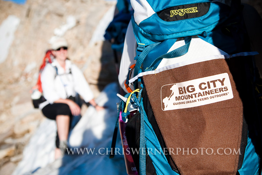
Jansport and Big City Mountaineers together on Mt. Langley. Photo courtesy of Chris Werner.

We awoke at 4:30am and enjoyed hot drinks and oatmeal as we finished preparations for our summit bid.  Our group took a nice steady pace while we enjoyed the scenery this spectacular landscape offers along with good conversation.  After reaching New Army Pass at 12,300′, 374m the team turned north ascending the gentle plateau that ends at a short section of 3rd class climbing.  Surmounting this short exhilarating area our route opened up to more gentle terrain dominated by white granite boulders leading to the summit plateau. Gaining the final pieces of elevation leading to the summit of Mt. Langley the views of the high Sierra became increasingly spectacular.   Finally we topped out on the southern-most 14er in the Sierra at 14,042’-4280M.

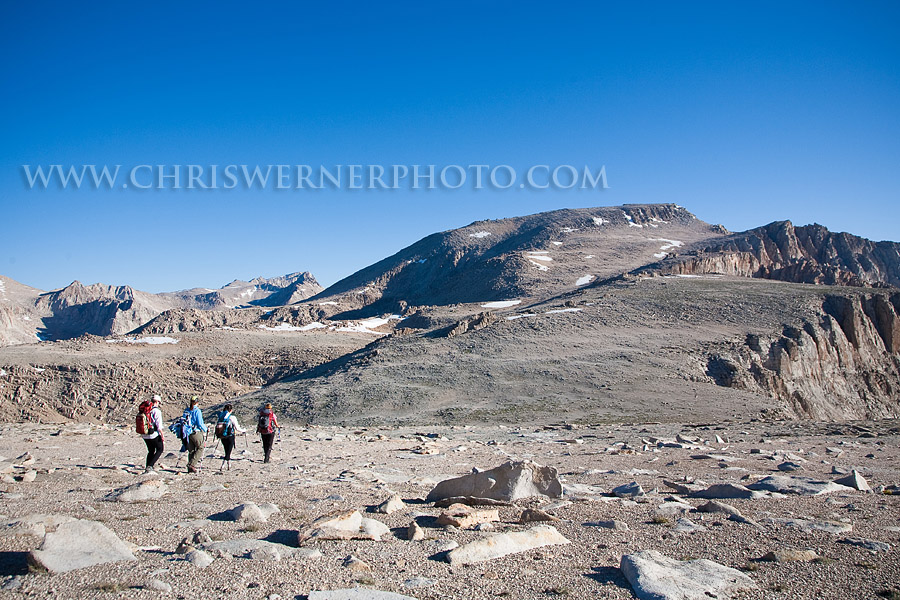
Sara, Carrie, Laura and Stacie head down from New Army Pass on the gentle plateau that leads to the summit of Mt. Langley. Photo courtesy of Chris Werner.

Another successful climb completed, we headed back to New Army Pass where both Sara Berghoff and Stacia attempted Cirque Peak only to be thwarted with an impending thunder shower just feet from the summit.  That afternoon the team was treated to thundershowers and a beautiful sunset.

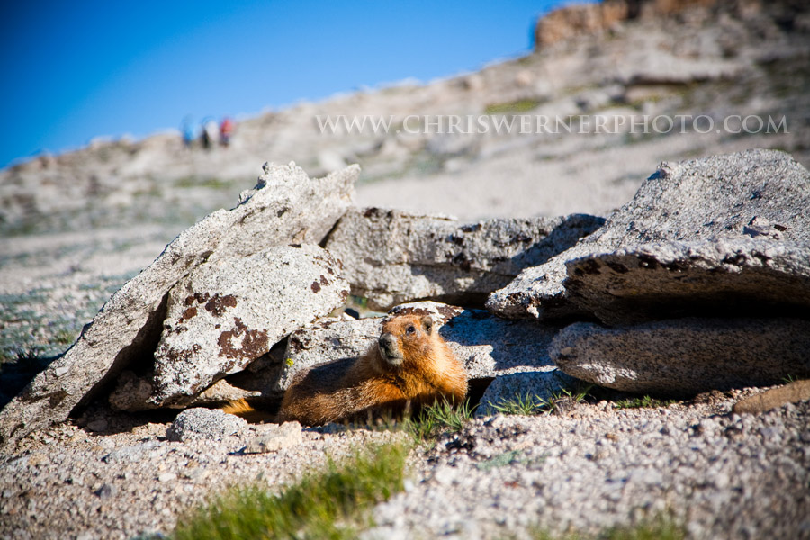
Yellow-bellied Marmots are everywhere in the Sierras! Photo courtesy of Chris Werner.

Thanks to the team and congratulations on a successful trip!

Summit for Someone, under Big City Mountaineers, is a program that benefits under privileged youth. More information can be found at www.summitforsomeone.org.

Mt Langley July 20th – 22nd

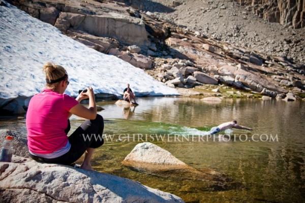
SMI Guide Sara Matisse videos the team swimming at High Lake on Mt. Langley. Photo courtesy of Chris Werner

On July 20th to 22nd SMI’s Chris Werner and Sara Berghoff teamed up with Jon Dorn, Chief Editor of Backpacker Magazine, Chip Noble of Delorme, Mike Byrne of Backpacker Magazine, and Steve Carlson of Spark Communication in a climb of Mt. Langley, the southernmost 14er in the Sierra.  This Backpacker Magazine climb benefited Big City Mountaineers, which is responsible for providing 7-8 day wilderness trips for inner-city and under privileged youth.

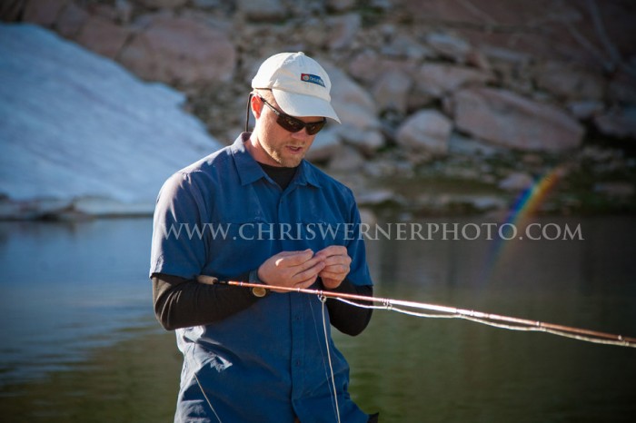
Chip Noble getting ready to do some fishing at High Lake. Photo courtesy of Chris Werner.

Our team enjoyed blue-bird skies and a pleasant hike up to High Lake at just over 10,400ft. We spent the afternoon swimming in the lake and enjoying views of the granite cirque that surrounded us.

The following morning we awoke at 4:30am to climb to the summit of Mt. Langley.  We started our hike just after sunrise – temperatures were perfect for the climb including a slight alpine breeze keeping things pleasant as we ascended the approx. 3,500ft to our high point and Mt. Langley’s summit at 14,042’, 4280m.

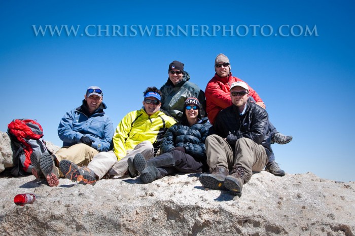
The team on the summit. From left to right: Steve Carlson, Jonathan Dorn, Mike Byrne, Sara Matisse, Chris Werner, Chip Noble. Photo courtesy of Chris Werner.

The whole team enjoyed the varied terrain, beautiful long reaching vistas, and Mt. Langley’s summit. After an hour of relaxation, photos, and some lunch we descended back down to our camp and enjoyed another afternoon swimming in the lake and napping the afternoon away.  Dinner was followed by a tasty desert, great stories and lots of laughs.

Thanks to Backpacker Magazine for bringing us together in support of BCM – another great trip!

Mt Elbrus July 25

After a successful hike yesterday the team slept well last night.  Everybody has been acclimating well and showing no signs of having trouble with the altitude.

We ate a good breakfast of fresh apples and oranges, toast, quesadillas, and granola then got ready for our next hike.  The goal was to get to 15,500′, 4724m.

At 9:40 we left the Diesel Hut under cloudy skies and warm temperatures.  As we climbed the weather would alternate between cloudy and sunny.  When the weather cleared we were treated to magnificent views.  Even when a cloud moved in we never had any precipitation.  The thermometer on my Suunto Core watch/wrist top computer read in the mid 60s when the sun was out and about 10-20 degrees cooler when a cloud surrounded us.  Overall the weather was pleasant conditions to hike in.

We hiked in 1 hour stretches then took breaks to eat and drink.  This procedure is also part of our training since this is how we intend to climb on summit day.  Taking a steady pace with regular breaks to refuel is the most efficient way to climb a big mountain.

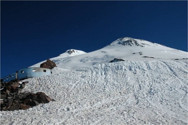
Elbrus from the Diesel Hut

After 4 hours we reached our high point of 15,500′, 4724m.  We took a 15 minute break then descended back to the Diesel Hut.

Although clouds obscured the summit all day we noticed a few people had reached the top and were descending past us.  The pleasant weather we had for hiking was apparently good enough for reaching the summit.  This was good news.

Upon returning to the hut we discussed making a summit attempt tomorrow.  The weather forecast is for similar conditions tomorrow as we had today.  Everybody is feeling great after our latest hike so the decision has been made to try for the summit in the morning.  We used the afternoon to organize our gear.  We ate an early dinner then went to bed at 6pm.

We are psyched and ready for our summit attempt tomorrow!