Category: Rock Climbing

Climbing Devils Crag

Devils Crag #1

A trip deep into the Sierra to climb Devils Crag #1 and Wheel Mountain

Climbing Devils Crag #1 involves ascending a knife edged 4th class ridge. The rock is loose and the route is wildly exposed in places. Devils Crags are a grouping of 12 summits along a fractured ridgeline tucked deep in Sequoia/Kings Canyon National Park. Devils Crag #1 is the most sought after because it is not only the highest at 12405’/3782m but it is also included on the Sierra Club’s Sierra Peaks Section Peak List. This list consists of 247 peaks in the Sierra divided into 24 geographical zones. Devils Crag is considered by many to be the most difficult peak on this list. In spite of this however, “sought after” is still a relative term. Devils Crag #1 sees very few ascents. Between September 2016 and this climb the mountain had only seen 6 ascents and nobody climbed it in 2017 or 2019.

Day 1: The Approach Day

Getting to Devils Crag is a long but beautiful hike. Starting at the South Lake Trailhead the approach beings with a 6 mile stretch over Bishop Pass (11973’/3649m), then 6.5 miles down to LeConte Canyon where it intersects with the John Muir Trail (8860’/2700m). Hiking south for another 2.6 miles leads to Grouse Meadow. It is here that the approach leaves the well traveled trail and immediately crosses the Middle Fork of the Kings River (8250’/2515m). After crossing the river and Grouse Meadow the unmarked route ascends a steep and unpleasant slope that is loose in places to 10000’/3048m. It then traverses across a long talus field that eventually intersects with Rambaud Creek. At 10400’/3170m a couple unnamed lakes are reached that offer decent camping options. All told it measured out to be 16.71 miles covered in just over 13 hours.

The Devils Crag team
The team from left to right: Hjordis Rickert, Trevor Anthes, Kurt Wedberg, Paul Garry, Kathy Rich, Bill Carpenter, Linda Sun, and Tristan Sieleman
Crossing the Middle Fork of the Kings River
Paul crossing the Middle Fork of the Kings River. The water was low this year. On some years it can be waist deep or deeper, especially earlier in the season.
Talus on the approach to camp
The talus traverse at approximately 10100′ on the approach to camp. Devils Crags are on the left skyline with seven of its summits in view.

Day 2: Getting to Devils Crag #1

Climbing Devils Crag #1 is usually done via the Northwest Arête. This 4th class ridge consists of complex terrain that requires careful thought and efficient rope work to maintain safety while making decent time. A headlamp start was indicated to maximize daylight because we anticipated a full day. A long talus slope led to Raumbaud Pass (11575’/3528m) in between Devils Crag and Wheel Mountain. After close to 3 hours of walking the team arrived at the start of the Northwest Arête.

Everybody geared up so we were prepared for the exposed terrain ahead. In addition to exposure another challenge on Devils Crag is loose rock. This poses difficulties assuring that hand and foot placements are solid, in making solid anchors for protection, and dislodging rocks that can be a hazard to parties below.

The Northwest Arête

Traversing a ridge and dropping elevation the route leads to a class 4 chute for 20m. Above here the exposure increases traversing past two large black rocks called the “Rabbit Ears”. Another short traverse drops slightly down to a 20m pitch of improbable 4th class. Moving above here the ridge widens slightly then reaches a wildly exposed 4th class 10m downclimb. Many consider this to be the crux because of the exposure and difficulty to protect it. Past this downclimb the ridge stays narrow over exposed 4th class terrain leading to the summit.

The start of the Northwest Arête
Looking at the start of the Northwest Arête on Devils Crag.
The 4th class chute
Bill climbing the 4th class chute on the Northwest Arête.
Approaching the Rabbit Ears
Linda and Tristan on the traverse to the Rabbit Ears.
Climbing through the Rabbit Ears
Bill climbing in between the “Rabbit Ears” on the Northwest Arête.
The upper half of the Northwest Bill climbing in between the "Rabbit Ears" on the Northwest Arête
Looking at the upper half of the Northwest Arête.
Sketchy anchor on Devils Crag
The Northwest Arête of Devils Crag has a few sketchy anchors along its route.
Kathy and Hjordis on the Northwest Arête
Kathy and Hjordis high on the Northwest Arête.
Bill on the Northwest Arête
Bill approaching the upper section of the Northwest Arête.
The final ridgeline to the summit.
Looking at the final ridgeline to the summit of Devils Crag #1.
Climbing on the upper reaches of the Northwest Arête.

The summit!

The summit of Devils Crag #1 offers spectacular views of the Sierra. There was time to soak in the magnificent scenery because the team climbed efficiently. It’s a special vantage point because so few people have ever been here. Smoke from a forest fire partially obscured the views but they were spectacular nonetheless.

The abundance of loose exposed 4th class topography on Devils Crag is some of the most complex terrain to guide. The alpine guide needs to have many skills in their quiver to employ on any given move. The techniques used will vary depending on several factors including (but not limited to) the weight ratio of the guide and guest, comfort, ability level, and weather elements such as wind. One rope team may use a certain technique on a particular feature then another team will come and do something different. What was agreed upon afterwards is everybody dug deep into their bag of tricks, and this route required constant vigilance with no breaks. It also proved to be a fun, challenging, and rewarding experience for all!

Kathy Rich summit photo
Kathy Rich summit photo on Devils Crag #1
Linda Sun summit photo
Linda Sun summit photo on Devils Crag.
Paul Garry summiting Devils Crag
Paul Garry climbing the final moves to the summit of Devils Crag.
Bill Carpenter summit of Devils Crag
Bill Carpenter adding his name to the summit register on Devils Crag.
Hjordis Rickert summiting Devils Crag
Hjordis Rickert coming onto the summit of Devils Crag.
Trevor Anthes arrives at the summit of Devils Crag
Trevor Anthes arrives at the summit of Devils Crag.
Tristan & Kurt summit Devils Crag
Tristan Sieleman & Kurt Wedberg on the summit of Devils Crag.
Devils Crag summit register can
The summit register can on Devils Crag showing evidence of lightning damage.

Descending off Devils Crag the team decided to return to camp instead of climbing Wheel Mountain on the same day. Arriving at camp that evening everybody cherished a safe and enjoyable climb on Devils Crag.

Day 3: Wheel Mountain

Wheel Mountain (12774’/3894m) is reached by going in the opposite direction at Rambaud Pass from Devils Crag. While rated class 3 the terrain is benign. There’s an occasional move that requires using hands but nothing that requires a rope.

The plan was to climb Wheel Mountain and after returning to camp to pack up and descend to the JMT. This would make for an easier hike out on Day 4.

Leaving after it got light Wheel Mountain proved to be an enjoyable climb. From its upper reaches the views of Devils Crag are fantastic. The route was easy enough to find and the views from the summit were even better than Devils Crag. From Rambaud Pass it was less than 2 hours to the summit. A little time spent in reflection and taking in the scenery was welcomed before returning to camp and navigating down to the JMT.

Morning start for Wheel Mountain
Morning start for Wheel Mountain.
Rambaud Pass
Kathy at Rambaud Pass en route to Wheel Mountain.
Wheel Mountain from Rambaud Pass
Wheel Mountain from Rambaud Pass.
Summit pinnacles on Wheel Mountain
Summit pinnacles on Wheel Mountain.
Summit Wheel Mountain
A little time of reflection on the summit of Wheel Mountain.
Ending shot at South Lake
The team arrives safely back to South Lake!
Old tat on Devils Crag
The team hauled out two old ropes and a large mound of UV worn webbing from Devils Crag.

Galleries with more photos are here and here.

SMI arranges ascents of Devils Crag and all 247 peaks on the SPS Peak List. Contact our office for details.

Mt. Humphreys Northwest Ridge

High on Mt. Humphreys NW Ridge

Mt. Humphreys Northwest Ridge is a fun and exhilarating way to climb this classic Sierra peak. Once considered a CA 14er, its current accepted elevation is 13986’/4263m. Nevertheless it is a lofty summit with outstanding views. The route features high quality granite with enough challenging and exposed moves to offer a thrilling sense of accomplishment.

Mt. Humphreys Northwest Ridge – The Approach

Mt. Humphreys Northwest Ridge is accessed from the North Lake trailhead at 9400’/2865m. The journey begins with a scenic 4.2 mile hike to Paiute Pass. This lovely hike ascends glacier carved granite benches past Loch Leven, Paiute, and several smaller alpine lakes to 11423’/3482m. Offering magnificent views it also gives access to Humphreys Basin. Leaving the trail the route ascends north over cross-country terrain to the base of Mt. Humphreys.

Mt. Humphreys Northwest Ridge

Longtime friend of SMI Ben Novak was Kurt Wedberg’s guest for this 1-day car to car ascent. Ben is a long distance ultra runner who has been climbing Sierra peaks with SMI for 10+ years. He’s also a veteran of our international destinations to Mexico’s Volcanoes and Aconcagua.

Doing the entire approach by headlamp the two opted to climb the massive south face of Mt. Humphreys to a notch that meets up with the North Couloir. From here the upper section of Mt. Humphreys Northwest Ridge is reached. On this day it offered spectacular climbing as the sun rose over the Sierra.

Upper NW Ridge of Mt. Humphreys
Looking at the upper Northwest Ridge of Mt. Humphreys from the top of the North Couloir.
3rd class gully on Mt. Humphreys NW Ridge
Ben climbing the 3rd class gully on Mt. Humphreys NW Ridge.

Roping up at the notch, the team ascended a 3rd class gully requiring the use of hands and feet that ended at a vertical wall. Careful route finding up the right side of the wall is the first of a handful of short class 4 pitches. The route climbs onto a spectacular ridgeline offering solid holds and spots of exciting exposure. This leads to the backbone of Mt. Humphreys Northwest Ridge. With the terrain dropping abruptly on either side the route looks improbable at first, but nevertheless a path opens up as one progresses higher.

Beginning the 4th class on the NW Ridge
Ben starting up the 4th class to gain the backbone of the NW Ridge of Mt. Humphreys.
Gaining the backbone of the NW Ridge of Mt. Humphreys
Ben gaining the backbone of the NW Ridge of Mt. Humphreys.
High on Mt. Humphreys NW Ridge
Ben enjoying the high quality granite climbing high on Mt. Humphreys NW Ridge. This route offers outstanding views of Humphreys Basin and the western landscape of the Sierra Nevada.
Thrilling climbing Mt. Humphreys NW Ridge
Ben enjoying the thrilling climbing on Mt. Humphreys NW Ridge.

The Summit and Descent

The summit of Mt. Humphreys is small enough to offer a dramatic 360 degree view because of its perch on a small point barely large enough for one climbing party. With clear calm weather there was enough time to refuel while soaking in the magnificent Sierra landscape before descending the NW Face to the SW slope. From here the descent through Humphreys Basin to Paiute Pass offered a leisurely and scenic way to wind down from this classic climb.

Topping out Mt. Humphreys NW Ridge
Ben climbing the final moves below the summit of Mt. Humphreys (13986’/4263m).
Ben Novak Mt. Humphreys summit
Ben Novak arriving at the summit of Mt. Humphreys (13986’/4263m) after a successful climb of the Northwest Ridge.
Kurt Wedberg on the summit of Mt. Humphreys
Kurt Wedberg on the summit of Mt. Humphreys (13986’/4263m) after guiding a successful climb of the Northwest Ridge.
Paiute & Loch Leven Lakes
Paiute and Loch Leven Lakes from the Pauite Pass trail just below the pass.
Lupine
Lupine’s in full bloom above Loch Leven Lake on the Paiute Pass trail.
Sierra Lily
Sierra Lily
Meadow Paintbrush
Meadow Paintbrush in bloom near Loch Leven Lake on the Paiute Pass trail.

View a photo gallery with more pictures from this climb here.

Contact SMI for climb Mt. Humphreys

Contact SMI to learn about guided climbs up Mt. Humphreys and the multitude of classic alpine climbs offered in the beautiful Sierra Nevada.

North Ridge of Mt. Conness

Stunning views high on the North Ridge of Mt. Conness!

Alpine rock climbing at its finest!

We experienced a picture perfect day on the North Ridge of Mt. Conness to kick off the alpine rock climbing season in the High Sierra! With summertime now upon us the high alpine climbs of the Sierra Nevada are at their finest. Longtime friend of SMI Michelle Kemmer joined us for a climb of the ultra classic North Ridge of Mt. Conness on July 9. Consisting of 6 pitches of moderate 5th class climbing plus an exciting rappel in the middle of the route this peak is pure alpine bliss. From steller granite to magnificent views of the alpine lakes, meadows, and granite spires in Tuolumne Meadows the North Ridge of Mt. Conness never disappoints!

The breathtaking approach!

The approach begins at Saddlebag Lake, which is a short distance off the Tioga Pass Road. The hike takes us past alpine lakes on a trail decorated with native wildflowers as it ascends to the base of the North Ridge.

Stunning morning scenery ascending above alpine lakes en route to the start of the North Ridge of Mt. Conness!

The beginning pitches and rappel of the North Ridge of Mt. Conness

We then roped up where the terrain narrows and becomes more exposed. A few short pitches in the difficulty range of 3rd to low 5th class led us to the first tower where two rappels lead to the upper end of the route.

Stellar granite and exhilarating views at the start of the North Ridge of Mt. Conness!
Rappelling off the tower on the North Ridge of Mt. Conness.

The top half of the North Ridge of Mt. Conness!

After short rappels the route presents four pitches of fun 5th class climbing on high quality granite with excellent hand and foot holds. Each belay station on the ascent reveals more exhilarating views en route to the 12590’/3829m summit!

Breathtaking backdrop approaching a belay station on the upper section of the North Ridge of Mt. Conness!
Stunning views below are the reward nearing the top of the North Ridge of Mt. Conness!
Hundreds of snowy peaks in the High Sierra provide the dramatic backdrop for a summit photo after a successful climb of Mt. Conness!
Kurt Wedberg, Mt. Conness North Ridge Summit
SMI founder Kurt Wedberg enjoys a picture perfect day from the summit after guiding a Mt. Conness North Ridge climb.

A complete photo gallery from this day can be viewed here. SMI arranges climbs of the North Ridge of Mt. Conness on any day between June 1 and October 15. Visit our website to learn about Mt. Conness and other classic Sierra Nevada alpine rock climbs. Reserve your spot today for a memorable adventure with our expert staff.

SMI Guides are back in action!

Mt. Whitney Summit!

SMI guides are ecstatic to be back guiding trips in the Sierra! We have spent this spring during the pandemic staying in shape, keeping sharp with our skills, and honing our craft. With things starting to open up again we are ecstatic to be once again outside sharing adventures in the Sierra Nevada with our guests.

The Sierra Nevada is our home, our back yard, and our favorite mountain range in the world. The possibilities for adventure and solitude are endless. Try ticking off some of our California 14ers on our Palisades trips, or the exhilaration from one of our classic alpine rock climbs. Learn to transfer your indoor climbing skills to the outdoor realm on one of our rock climbing programs, or discover pristine destinations in the Sierra Nevada through one of our customized backpacking trips! Whatever your desire the Sierra Nevada has it all!

During the month of July join any SMI trip in 2020 and receive a free custom SMI UPF 50+ Buff!

Sierra Gem – Bear Creek Spire

IMG_4312

The beautiful Bear Creek Spire

Lately, it seems, our guides have been spending a lot of time climbing Bear Creek Spire. With multiple classic routes of varying levels, BCS is a beauty of a peak, nestled in the Little Lakes Valley of the High Sierra between Bishop and Mammoth.

DSC_1550

SMI Guide, Ross Hill, leading a pitch on the North Arete

The two most popular routes on BCS are the North Arete, a 1200′ climb rated 5.8 for its most challenging pitch, with most pitches 5.5 or lower, and the Northeast Ridge, rated 5.5. The approach to both involves a very gradual trail over about 3.5 miles, followed by some talus hopping and off-trail navigation for about 2 more. You will likely contend with a snow field at the base, depending on time of year.

We are happy to take you on a climb of Bear Creek Spire this season, if you’re inspired by these photos! If you’re in good mountain shape, the Ridge could be turned around in a 2 day trip. We’d recommend a 3 day trip for the Arete, but 2 days might be appropriate for a strong climber.

Client, Ben Novak, climbing the Northeast Ridge


The Lost Arrow Direct, Yosemite Valley V 5.9/A2 – C2


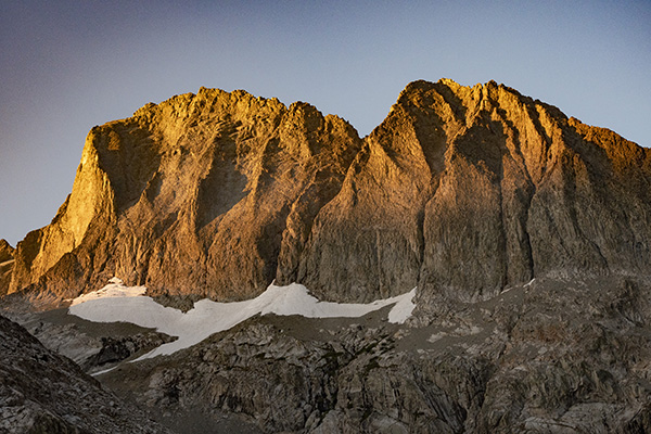
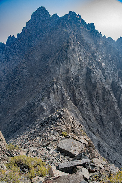
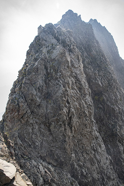
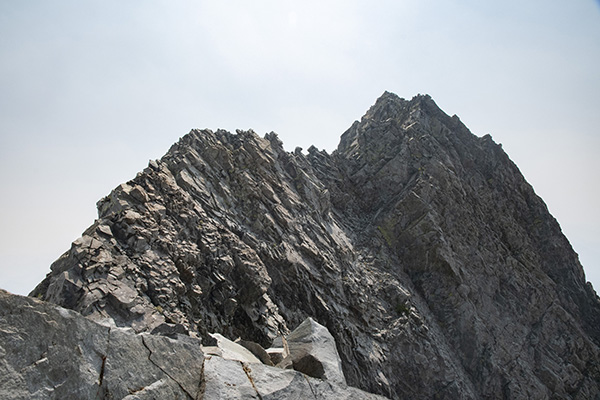
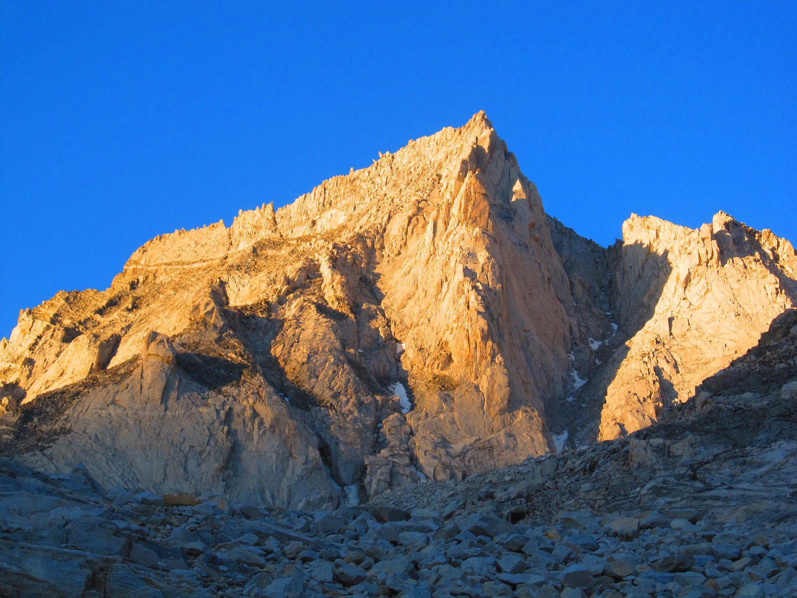
The Lost Arrow Spire is the needle protruding out of the face to the right of Yosemite Falls.

This is a report of a climb of Yosemite’s Lost Arrow Spire as written by Kurt Wedberg.

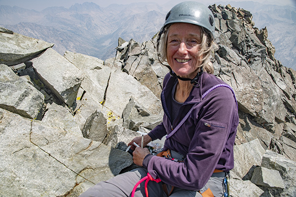
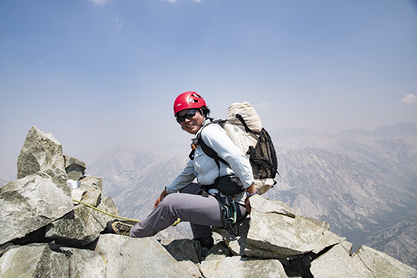
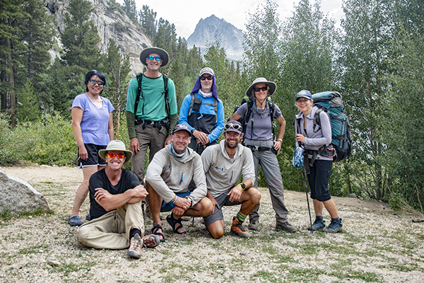
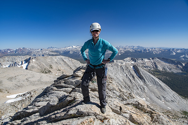
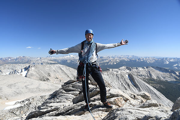
On September 27-30 SMI founder Kurt Wedberg joined big wall veteran Skiy Detray and Amanda Fenn for a climb of this famous feature in Yosemite Valley.  Amanda is a strong climber who spent this past summer expanding her resume and climbing skills into the alpine environment.  Skiy is a veteran of 40+ big walls and served several summers on YOSAR, the Yosemite Search and Rescue.  He spent most of this past summer in Pakistan on the Great Trango Tower (6,286 m/20,623 ft), a striking rock formation above the Baltoro Glacier in the Karakoram.  He also has set speed records for ascents of routes in Yosemite.  Shortly after our climb of the Lost Arrow Spire he did the first one day ascent of El Capitan’s Scorched Earth A4 5.8 in 22:28 and Tribal Rite A4 5.5 in 19:48.  Needless to say his knowledge and depth of experience were a treat to glean from.  It was a pleasure to share a rope with both Skiy and Amanda.  To have the opportunity to share a 4-day climb of one of the most well known features in Yosemite was truly a privilege.  The Lost Arrow gets its name from an Indian legend.  The story of the Lost Arrow is included at the bottom of the photo essay.

Below is a short photo essay of our climb.  The entire photo galleries from all three team member’s cameras can be found here:

Amanda’s Lost Arrow Spire Pictures

Kurt’s Lost Arrow Spire Pictures

Skiy’s Lost Arrow Spire Pictures

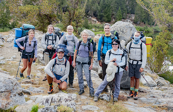
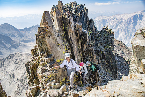
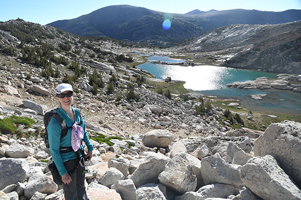
Skiy and Amanda with haul bags loaded and ready for the approach.

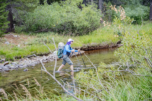
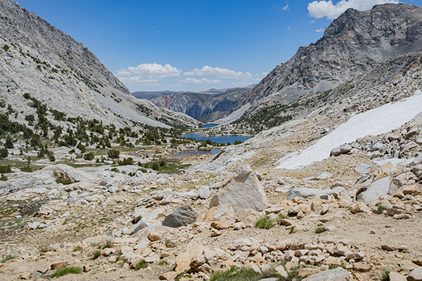
Crossing the creek below Yosemite Falls on the approach to the Lost Arrow Spire.

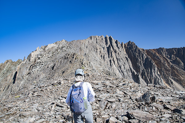
The Lost Arrow Spire directly above with Yosemite Falls on the left.

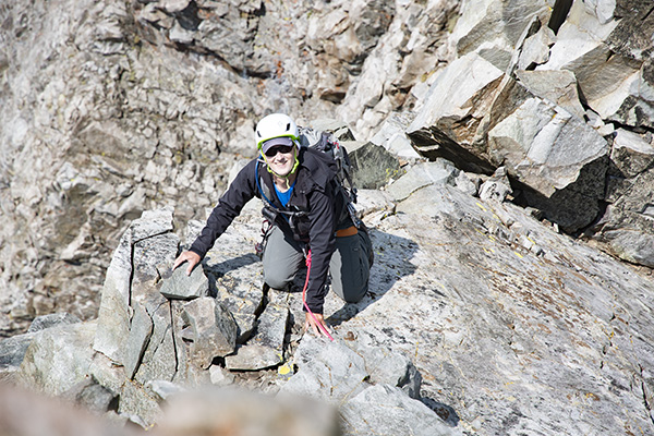
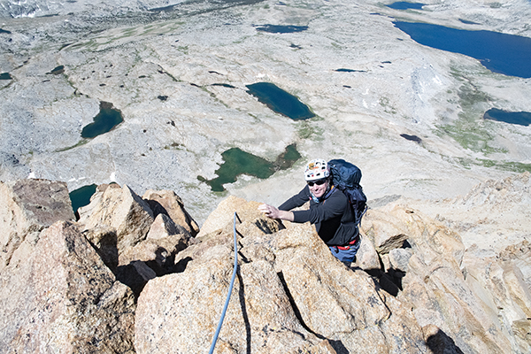
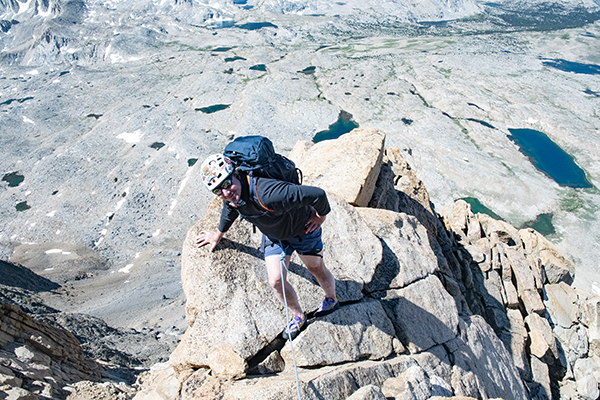
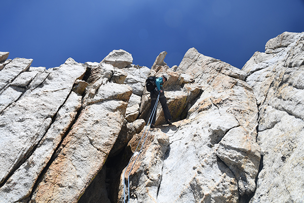
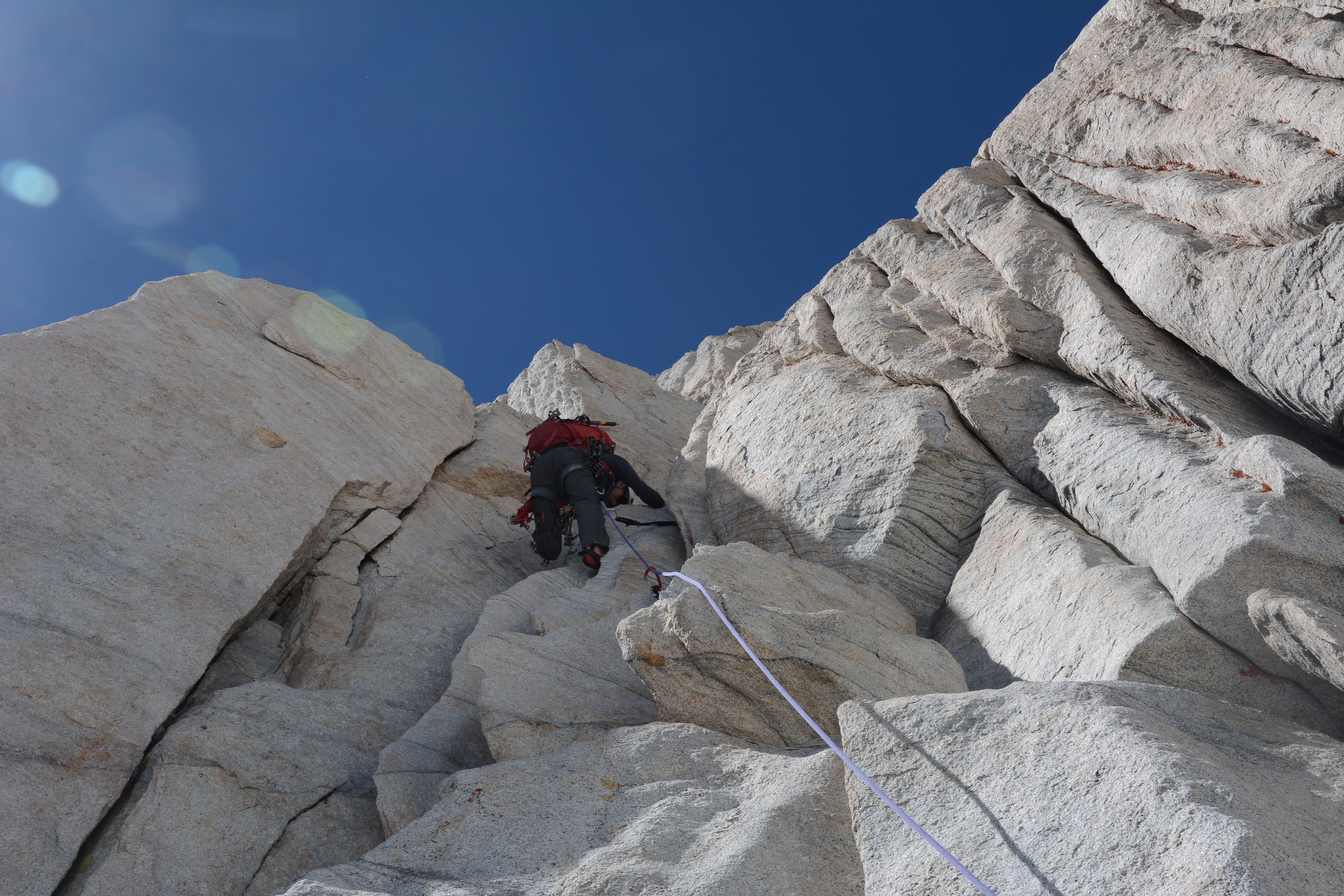
Skiy ascending up pitch #1.

Amanda leading pitch #2.

Skiy leading the wide "off width" on pitch #3.

Amanda and a typical anchor station on day 1.

After dinner bedded down for the night on a small ledge four pitches up.

The morning sunlight creating a rainbow on Yosemite Falls.

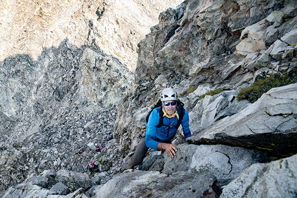
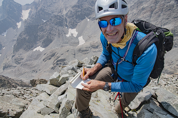
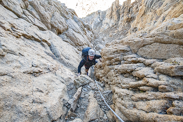
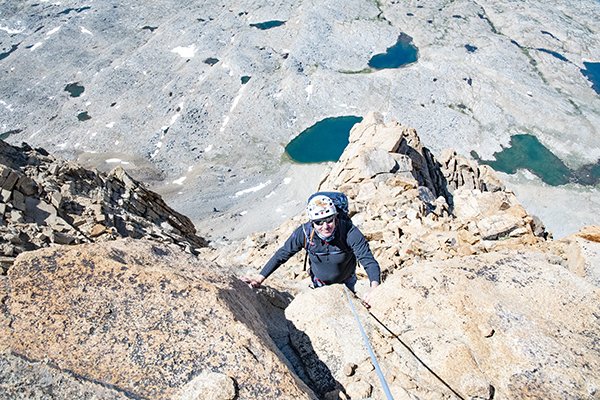
Kurt leading pitch #5 on the morning of day 2.

Our goal tonight is the upper tree. Kurt is leading a pitch in the lower right of this photo.

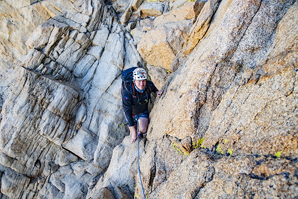
Amanda taking off on the lead for pitch #6.

Skiy and our haul bags at a belay station.

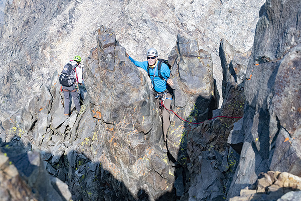
Skiy taking off on a lead with our destination tree getting closer.

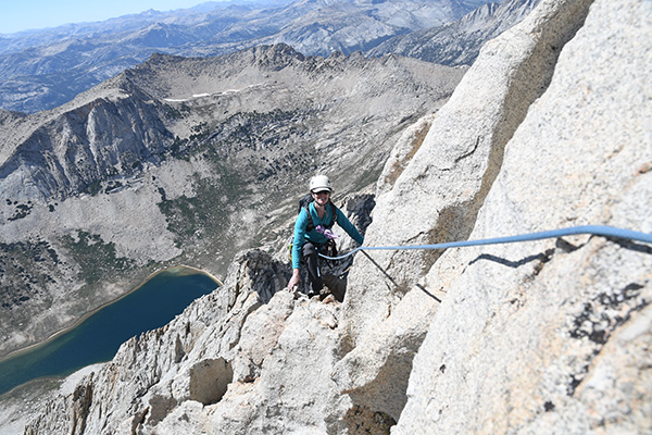
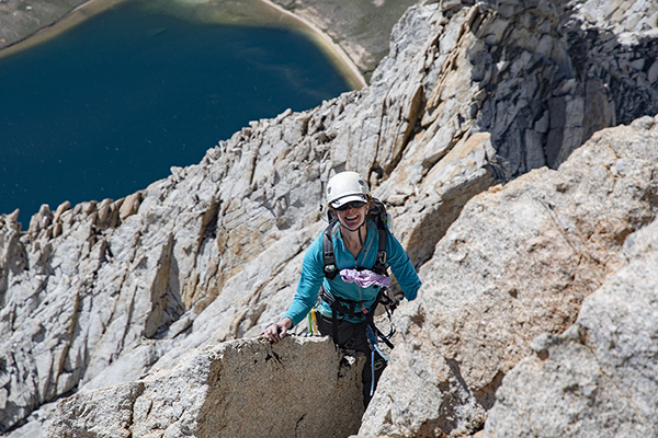
Amanda high up leading on pitch #8.

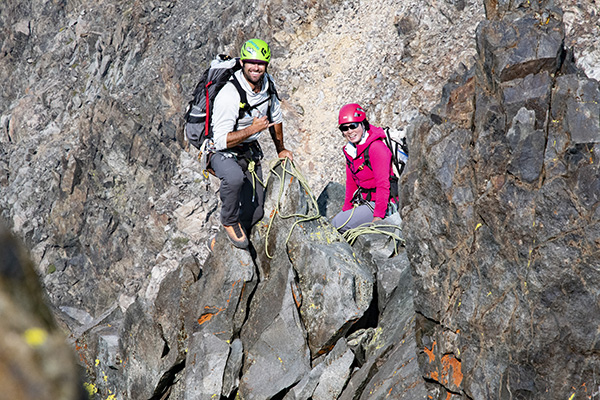
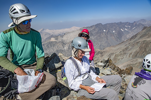
Skiy on the morning of day 3 relaxing on the ledge we slept on the night before.

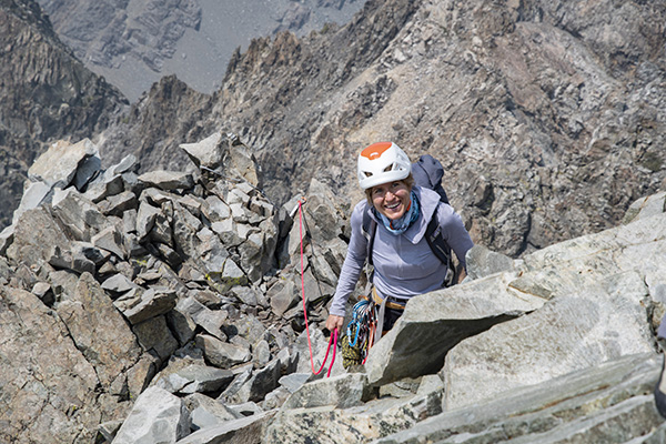
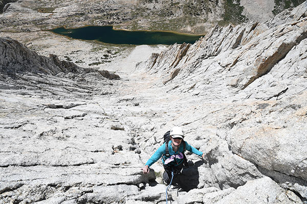
Amanda leading a pitch on day 3.

Amanda high up on a lead with her gear she placed showing her line of ascent.

Anchored off and bedded down after dinner on a small ledge at the end of day 3.

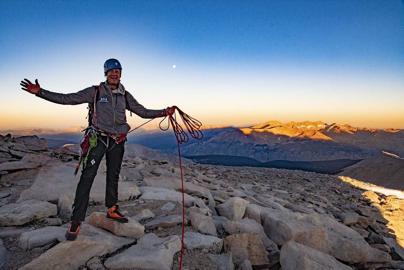
The warming rays of the morning sun made for a peaceful morning on day 4 with Yosemite Valley far below.

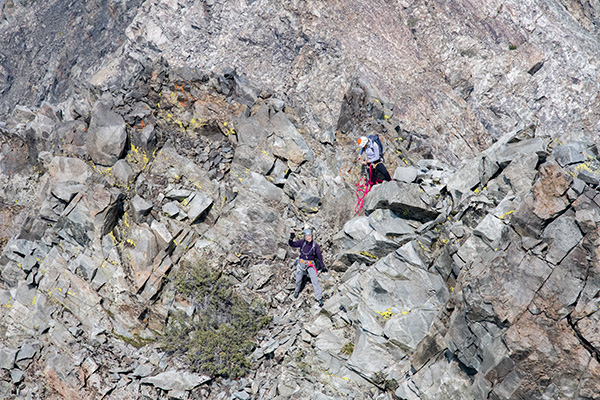
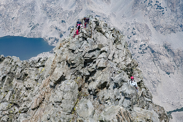
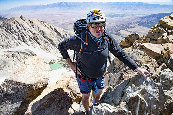
Skiy and Amanda from "the notch" where the Lost Arrow Spire separates from the main wall. We will climb two more pitches to the top of the pinnacle then do a Tyrolean Traverse to get back to the main face.

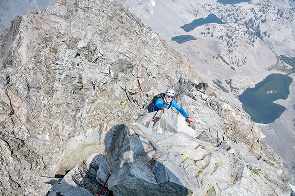
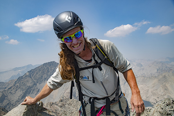
Skiy hamming it up on pitch 14 on a beautiful fall morning in Yosemite.

The view of Kurt's feet looking down from the middle of pitch #14.

Amanda taking off to lead the final pitch of climbing.

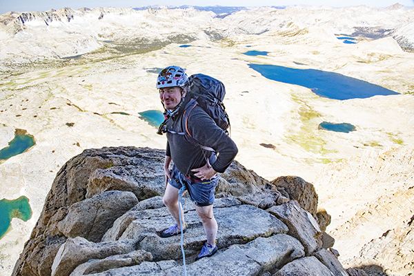
Skiy and Amanda at the top of the Lost Arrow Spire.

Now we have to traverse approximately 140' on a rope to get to the main wall and finish the climb.

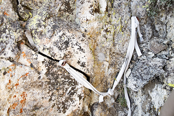
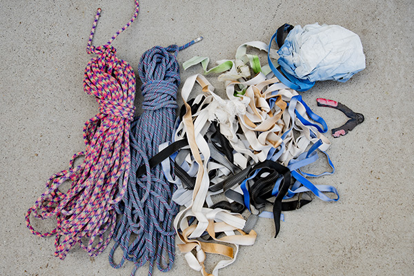
Skiy removing old UV damaged webbing on the anchor we would use for the traverse.

Kurt securing new webbing for the anchor.

Our anchored ropes leading off over the expanse. We had a friend anchor these ropes to the main face a couple days before we arrived.

Skiy volunteered to be the first to test our anchor system.

Skiy nearing half way on the traverse.

Amanda's turn. Skiy is just to the left of Amanda's head with a perfect view of all the action.

Wind picked up in the afternoon adding to the excitement as Amanda traversed.

View looking down in the middle of the traverse.

The final bit to ascend to finish the climb.

Kurt on the Tyrolean Traverse. Photo by Skiy Detray.

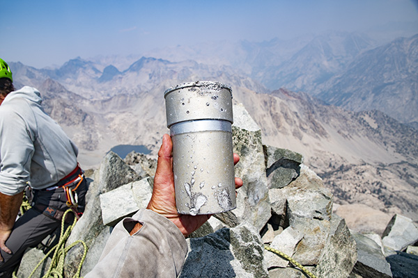
In addition to fixing ropes we were left with a little present to celebrate out climb!

After a good night's sleep it was time to hike down. We loaded our haul bags and descended down the Yosemite Falls trail.

Loading heavy haul bags on your back is a great squat workout.

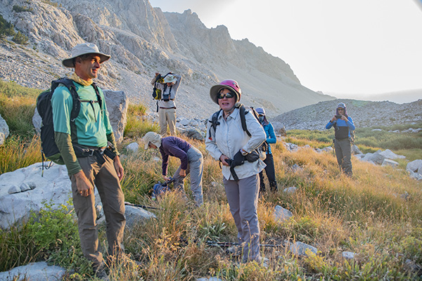
On the descent we got a surprise and very welcomed visit from our good friends Trish, McKenzie, and Drew. They met us on the trail with fresh bananas, hot breakfast burritos, and EMPTY PACKS!!

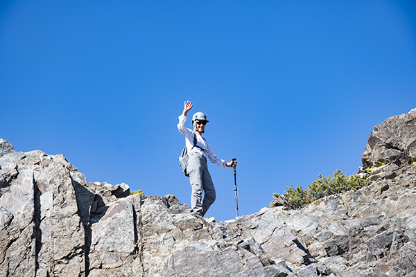
Three amigos with our route behind.

THE LEGEND OF THE LOST ARROW

Kos-su-kah, a young chief of the Ah-wah-nee-chees, smiled upon a maiden, Tee-hee-nay. Kos-su-kah was tall and strong and brave. Among all the sons of Ah-wah-nee there was none so keen of sight, so swift of foot, or so skilled in the use of the bow and the arts of the chase. Tee-hee-nay was the fairest and most beautiful of all the fair daughters of Ah-wah-nee. She was tall and slender as the fir, and as graceful and supple as the stem of the azalea. Her hands and feet were small and beautifully shaped, her silken hair was black as a moonless night and fell in a cloud to her knees. Her eyes were luminous pools of light, and her voice was liquid in its sweetness. Her laugh was like the musical tinkling of the brook, and she was good as she was beautiful.

Tee-hee-nay smiled upon the handsome Kos-su-kah, thereby confessing her love for him, and nothing remained but the formal presentation, by Kos-su-kah, of suitable gifts to her parents, and the preparation of a feast to celebrate their wedding. Kos-su-kah’s suit was approved by the parents of Tee-hee-nay and the lovers were filled with joy. They began preparations immediately for a royal wedding feast. To do this Tee-hee-nay, assisted by the maidens of the tribe, would gather acorns and prepare the acorn bread and mush, collect grass seeds, wild fruits and edible roots; while Kos-su-kah should gather about him the best hunters of his tribe and participate in a big., hunt on the high mountains that there might be an abundance of meat for the feast, to which the entire tribe would be invited.

Before saying their good-byes it was agreed between them that at sunset Kos-su-kah should go to the column of rock which stands just to the east of Cho-lak (Yosemite Fall), and from there launch from his strong bow into the Valley an arrow, bearing on its shaft grouse feathers corresponding in number to the deer that had fallen before the skill of himself and his companions. That she might mark the flight of the arrow and the spot of its falling, and thus be the first to carry news of the success of the hunt to her tribe, Tee-hee-nay was to go at sunset to the base of the cliff and there watch for the signal.

After a most successful hunt, while his companions were making camp for the night, and preparing their game for transportation down to the Valley, Kos-su-kah made his way to the point agreed upon, prepared the signal arrow, and was just ready to send it on its mission into the Valley, when the cliff’s edge on which he was standing, gave way, carrying him with it and hurling him to his death on the rocks below.

After the seemingly endless day of waiting, Tee-hee-nay made her way to the appointed spot, and as the sun went down behind the cliffs, stood straining her eyes up to the heights, hoping to catch a glimpse of the manly form of her lover. But when night had settled his dusky mantle over the Valley, Kos-su-kah had failed to appear, and no signal arrow had winged its way down from the cliff above. Thinking that the chase had led him farther afield than they had anticipated, that he had been unable to reach the cliff before darkness, and, knowing that his signal arrow would not be seen, he was, even now, making his way down the boulder strewn trail of Indian Canyon to deliver in person his message, she bound up the trail hoping to meet him. Over rocks and fallen trees from ledge to ledge, over precipices where a misstep meant certain death she hurried until at last she gained the foot of the cliff at a point from which, should he come, she could not miss him. There, through the long hours of the night, she waited and listened, longing for the welcome sound of his footsteps or his dear voice, and sending winging through the dark void of the night sobbing, passionate prayers to The Great Spirit for the safety of her loved one.

But when the first rosy fingers of dawn lit up the eastern sky and brought no sight of her lover, she sprang like a deer up the steep trail to the top of the cliff, and hurried to the spot from which the signal was to have been given. She called to Kos-su-kah, but only the echo of her voice came back in answer to her yearning cry. Reaching at last the edge of the cliff she came to the point from which a large portion had but recently fallen away. With sobbing breath and a heart numb with an awful certainty, she forced herself to look over the edge, and saw lying far below, the blood-stained lifeless body of her lover.

Stunned by the terrible grief of her loss Tee-hee-nay built, on the top of the cliff, a signal fire and summoned help from the tribe below. The heavy, lagging hours of waiting dragged away, and at last the asked for help arrived. Preparations were at once made for the recovery of the lifeless body of Kos-su-kah. A rope was fashioned from the trunks of young tamaracks by lashing them together with the thongs of the deer that were to have furnished the meat for the wedding feast. When this was finished a young chief prepared to descend, but Tee-hee-nay pushed him aside. She herself must be the first to reach her lover, her hands the ones to perform this sad service. The sympathetic braves lowered her gently down the cliff until she stood beside Kos-su-kah’s battered body. After gently kissing his cold, unresponsive lips she unwound from around her waist the thongs of deerskin and bound his body firmly to the rope, then watched in loving anxiety while the braves gently raised him to the cliff top. The rope was again lowered and Tee-hee-nay was drawn up to the side of her dead lover. Then she, who up to this time had been so brave, gave way to a passionate storm of grief. Throwing herself across the body of her loved one she entreated him to speak to her, sobbing prayers to The Great Spirit for the return of her dead. After a while her cries ceased and she grew quiet. When gentle hands stooped to lift her she fell back lifeless. She had died of a broken heart and her gentle spirit had winged its way to join her lover’s in El-o-win, the spirit land beyond the setting sun.

Reverent hands brought the two bodies of the lovers, now reunited in death, down into the Valley, placed them side by side upon the funeral pyre, and scattered their loved. The signal arrow was never found, having been spirited away by the reunited lovers to El-o-win as a memento of their unfaltering love. And in memory of the beautiful maiden and the noble chief, the slender spire of granite, still standing there near the spot where Kos-su-kah’s body was found, has ever since been known to the sons and daughters of Ah-wah-nee, as Hum-mo, or the lost arrow.